
Bull Mountain (Garfield County, Utah) facts for kids
Quick facts for kids Bull Mountain |
|
|---|---|

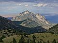
Northeast aspect, from Highway 95
(Snow-capped Mt. Ellen in back} |
|
| Highest point | |
| Elevation | 9,187 ft (2,800 m) |
| Prominence | 1,347 ft (411 m) |
| Isolation | 2.83 mi (4.55 km) |
| Geography | |

Bull Mountain
Location in Utah

Bull Mountain
Location in the United States
|
|
| Location | Garfield County, Utah, U.S. |
| Parent range | Henry Mountains |
| Topo map | USGS Bull Mountain |
| Type of rock | Igneous |
| Climbing | |
| Easiest route | class 2 scrambling |
Bull Mountain is a tall mountain in Utah, USA. It stands at 9,187 feet (about 2,800 meters) high. You can find it in Garfield County, in the northern part of Utah.
Bull Mountain is part of the Henry Mountains. These mountains are located between Capitol Reef National Park to the west and Glen Canyon National Recreation Area to the east. Nearby are Mount Ellen and the Burr Desert. This area is dry, rugged, and not many people live there. It is managed by the Bureau of Land Management. Rain and snowmelt from the mountain flow into the Colorado River. The closest town is Hanksville, about 17 miles (27 km) north.
Mountain Climate
The best times to visit Bull Mountain are in spring and fall. It has a "cold semi-arid" climate. This means winters are cold, with average temperatures below 32°F (0°C). Most of the rain and snow falls in spring and summer. This desert area gets less than 10 inches (250 mm) of rain each year. Winter snowfall is usually light.
Images for kids
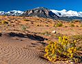
-
South aspect
-
Northeast aspect
-
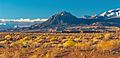
From the north


