Bull Run (Occoquan River tributary) facts for kids
Quick facts for kids Bull Run |
|
|---|---|
|
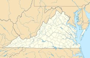
Location of Bull Run mouth
|
|
| Other name(s) | Tributary to Occoquan River |
| Country | United States |
| State | Virginia |
| County | Fairfax Prince William Loudoun |
| Physical characteristics | |
| Main source | Hungry Run divide Cold Spring Gap 660 ft (200 m) 38°56′21″N 077°39′11″W / 38.93917°N 77.65306°W |
| River mouth | Occoquan River about 1 mile northeast of Ravenwood, Virginia 120 ft (37 m) 38°43′21″N 077°22′51″W / 38.72250°N 77.38083°W |
| Length | 31.80 mi (51.18 km) |
| Basin features | |
| Progression | southeast |
| River system | Potomac River |
| Basin size | 193.89 square miles (502.2 km2) |
| Tributaries |
|
| Bridges | Loudoun Drive, New Road, US 15, Peach Orchard Lane, Auburn Farm Road, Gum Spring Road, US 29, I-66, Old Centerville Road, VA 28, VA 612 |
Bull Run is a stream in Virginia, USA. It is about 31.8 miles (51.2 km) long. Bull Run starts from a spring in the Bull Run Mountains in Loudoun County. It then flows south until it reaches the Occoquan River.
This stream is important because it forms natural borders. It separates Loudoun County from Prince William County. It also divides Fairfax County from Prince William County.
Contents
Bull Run and the Civil War
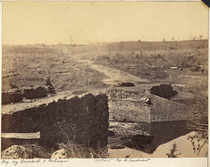
Bull Run is famous for two major battles during the American Civil War. These battles were fought near its banks.
First Battle of Bull Run
The First Battle of Bull Run happened on July 21, 1861. It was the first big land battle of the Civil War. The Confederate army won this battle.
Second Battle of Bull Run
The Second Battle of Bull Run took place from August 28 to 30, 1862. This was another important victory for the Confederate forces.
Historic Crossings
A narrow part of Bull Run is called Yates Ford. A "ford" is a shallow place where you can cross a river. The Battle of Occoquan happened near Yates Ford.
About one mile downstream from Yates Ford, you can find the Yates Ford Road bridge. This bridge connects Fairfax and Prince William counties.


