Bull Run Mountains (Nevada) facts for kids
Quick facts for kids Bull Run Mountains |
|
|---|---|

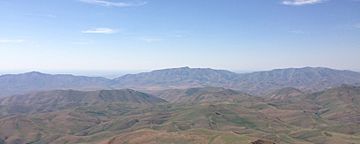
Bull Run Mountains viewed from the Independence Mountains
|
|
| Highest point | |
| Peak | Porter Peak |
| Elevation | 2,791 m (9,157 ft) |
| Geography | |
| Country | United States |
| State | Nevada |
| District | Elko County |
| Range coordinates | 41°50′7.644″N 116°8′38.350″W / 41.83545667°N 116.14398611°W |
| Topo map | USGS Dry Creek Reservoir |
The Bull Run Mountains are a cool mountain range located in Elko County, Nevada, in the United States. These mountains are a big part of the Humboldt-Toiyabe National Forest. The highest point in the range is Porter Peak, which stands tall at about 9,157 feet (2,791 meters).
Contents
What are the Bull Run Mountains?
The Bull Run Mountains are a chain of mountains in northeastern Nevada. They stretch across a large area in Elko County. Much of this mountain range is protected within the Humboldt-Toiyabe National Forest. This means the land is managed to keep its natural beauty and wildlife safe.
Where are they located?
You can find the Bull Run Mountains in the northern part of Nevada. They are specifically in Elko County. This area is known for its wide-open spaces and beautiful natural landscapes.
Porter Peak: The Highest Point
The tallest spot in the Bull Run Mountains is called Porter Peak. It reaches an elevation of 9,157 feet (2,791 meters). Imagine standing on top of that! From there, you would get an amazing view of the surrounding area.
How Did the Mountains Get Their Name?
The Bull Run Mountains got their name to remember an important event in American history. They were named after the First Battle of Bull Run. This was one of the first major battles of the American Civil War. The American Civil War was a big conflict in the United States that happened from 1861 to 1865. It was fought between the northern states (the Union) and the southern states (the Confederacy).
 | Emma Amos |
 | Edward Mitchell Bannister |
 | Larry D. Alexander |
 | Ernie Barnes |


