Buslingthorpe, Leeds facts for kids
Quick facts for kids Buslingthorpe |
|
|---|---|
| Metropolitan borough | |
| Metropolitan county | |
| Region | |
| Country | England |
| Sovereign state | United Kingdom |
| Post town | LEEDS |
| Postcode district | LS7 |
| Dialling code | 0113 |
| Police | West Yorkshire |
| Fire | West Yorkshire |
| Ambulance | Yorkshire |
| EU Parliament | Yorkshire and the Humber |
| UK Parliament |
|
Buslingthorpe is an area in Leeds, West Yorkshire, England. It is located about one mile north of the city centre. This area is part of the Hyde Park and Woodhouse ward, which is managed by the City of Leeds Council. In the 1950s, many homes in Buslingthorpe were taken down as part of a plan to improve old housing areas.
What's in a Name? The Story of Buslingthorpe
The name Buslingthorpe was first written down in 1258 as Buselingtorpe. It probably means "Buselin's farmstead." The name comes from an old French personal name, Buselin, combined with the word thorpe. Thorpe is an old word that means a "secondary settlement" or a "small farm." It came into English from the Old Norse word þorp.
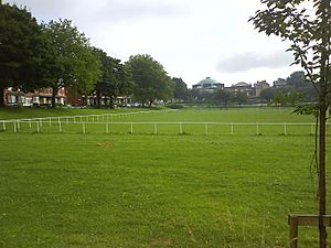
In 2009, a park in Buslingthorpe was named Norma Hutchinson Park. This was done to remember Norma Hutchinson, a councillor from Jamaica who passed away in 2004.
Buslingthorpe's Past: A Quick Look
Buslingthorpe was a special church area from 1849 to 1955. Between 1870 and 1872, it was a smaller church district within the larger Leeds parish. At that time, about 4,548 people lived in 998 houses in Buslingthorpe.
The Church of St Michael was built in Buslingthorpe Lane between 1852 and 1854. It was designed by an architect named O. W. Burleigh from Leeds. However, this church was later taken down in the late 1950s or early 1960s.
 | Valerie Thomas |
 | Frederick McKinley Jones |
 | George Edward Alcorn Jr. |
 | Thomas Mensah |


