Cache Creek (Oklahoma) facts for kids
Quick facts for kids Cache Creek |
|
|---|---|

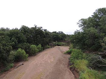
Cache Creek sandbar geology including the periodic variations in stream flow and water level.
|
|
| Country | United States |
| State | Oklahoma |
| Region | Southwestern United States |
| Physical characteristics | |
| Main source | Confluence of East Cache Creek and West Cache Creek Temple Cotton County Oklahoma, Southwestern United States, United States 915 ft (279 m) 34°12′23″N 98°18′23″W / 34.20639°N 98.30639°W |
| River mouth | Red River Taylor, Oklahoma, Southwestern United States, United States 888 ft (271 m) 34°08′00″N 98°16′05″W / 34.13333°N 98.26806°W |
| Length | 5.5 mi (8.9 km) |
| Basin features | |
| River system | Red River |
| Basin size | 796 sq mi (2,060 km2) |
| Tributaries |
|
Cache Creek is a small stream located in Cotton County, Oklahoma. It is a tributary, which means it flows into a larger river. Cache Creek joins the Red River.
The main part of Cache Creek is about 5.5 miles (8.85 km) long. It starts where two other streams, East Cache Creek and West Cache Creek, meet. This meeting point is about 6 miles (9.75 km) southwest of Temple, Oklahoma.
Cache Creek gets its water from three main streams: East Cache Creek, West Cache Creek, and Deep Red Creek.
Contents
East Cache Creek: Where Does It Start?
East Cache Creek begins about 6.5 miles (10.41 km) northwest of Meers, Oklahoma. It then flows into the Cache Creek area southwest of Temple, Oklahoma.
This creek is about 50 miles (80 km) long. It starts at an elevation of 1,725 feet (526 meters) and flows down to 915 feet (279 meters).
Many smaller streams and lakes feed into East Cache Creek. These include Elmer Thomas Lake, Lake Ellsworth, Lake Lawtonka, Little Medicine Creek, Medicine Creek, Snake Creek, and Soldier Creek.
West Cache Creek: Its Journey
West Cache Creek starts about 6.5 miles (10.6 km) south of Saddle Mountain, Oklahoma. It also flows towards the Cache Creek area near Temple, Oklahoma.
This creek is approximately 45 miles (72 km) long. It begins at a higher elevation of 1,961 feet (598 meters) and flows down to 915 feet (279 meters).
Several lakes and creeks are tributaries to West Cache Creek. Some of these are Gramma Lake, Comanche Lake, Kiowa Lake, French Lake, Fish Lakes, Lost Lake, Quanah Parker Lake, Crater Lake, Canyon Lake, Crater Creek, Blue Beaver Creek, Lake Rush, Lake Jed Johnson, Ketch Lake, Pecan Creek, and Sandy Creek.
Deep Red Creek: A Key Contributor
Deep Red Creek starts about 4.5 miles (7.34 km) west of the Charon Gardens Wilderness Area, near Odetta, Oklahoma. It flows into West Cache Creek.
This creek is about 43 miles (69 km) long. It starts at an elevation of 1,567 feet (478 meters) and flows down to 957 feet (292 meters).
Lake Frederick and Little Deep Red Creek are two streams that feed into Deep Red Creek.
How Much Water Flows?
The amount of water flowing in a creek is called its discharge. This table shows the average discharge for the main parts of Cache Creek and its tributaries:
| Name of Creek | Location | Average Water Flow (cubic feet per second) |
|---|---|---|
| East Cache Creek | Walters | 223 cu ft/s (6.3 m3/s) |
| West Cache Creek | Cookietown | 182 cu ft/s (5.2 m3/s) |
| Deep Red Creek | Randlett | 168 cu ft/s (4.8 m3/s) |
| Cache Creek | Where it meets the Red River | 573 cu ft/s (16.2 m3/s) |
 | Charles R. Drew |
 | Benjamin Banneker |
 | Jane C. Wright |
 | Roger Arliner Young |


