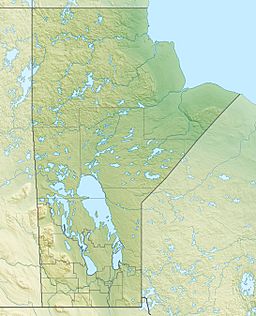
Caddy Lake facts for kids
Quick facts for kids Caddy Lake |
|
|---|---|
| Location | Whiteshell Provincial Park, Manitoba |
| Coordinates | 49°48′48″N 95°12′34″W / 49.81333°N 95.20944°W |
| Type | glacial |
| Part of | Nelson River Drainage Basin |
| Primary inflows | Whiteshell River |
| River sources | McGillivray Creek |
| Primary outflows | Whiteshell River |
| Basin countries | Canada |
| Surface area | 300 hectares (740 acres) |
| Max. depth | 5.7 metres (19 ft) |
| Water volume | .026 cubic kilometres (0.0062 cu mi) |
| Residence time | 1.15 years |
| Shore length1 | 16.04 kilometres (9.97 mi) |
| Surface elevation | 316 metres (1,037 ft) |
| Islands | 2 (Boutilier Island) |
| 1 Shore length is not a well-defined measure. | |
Caddy Lake is a beautiful lake located in southeastern Manitoba, Canada. It is very close to the border with Ontario. This lake is a part of the amazing Whiteshell Provincial Park, not far from West Hawk Lake.
Caddy Lake covers an area of about 300 hectares (that's like 740 football fields!). At its deepest point, the lake is about 5.7 meters (or 19 feet) deep.
Contents
Discover Caddy Lake
Caddy Lake is a popular spot for many fun activities. It's known for its clear waters and natural beauty. People come here to enjoy the outdoors and relax.
What Can You Do at Caddy Lake?
Many people love to visit Caddy Lake for outdoor adventures. There are lots of things to do here, especially if you enjoy nature and water sports.
Fishing Fun
Fishing is a very popular activity at Caddy Lake. Anglers (that's what serious fishers are called!) often catch many different types of fish. Some of the fish you might find include:
Camping and Cottages
If you love camping, you're in luck! The province of Manitoba runs a seasonal campground right on the western side of Caddy Lake. This is a great place to set up a tent or park an RV. Around the lake, you'll also find many cottage areas. These are places where people have built vacation homes.
Girl Guide Camp
There's a special place on the north side of Green Bay called the Caddy Lake Girl Guide Camp. This camp was started way back in 1949. It's a place where Girl Guides can learn new skills and enjoy the outdoors.
How Caddy Lake Got Its Name
Caddy Lake was named in 1925. It got its name from a person named J.S. Caddy. He was an engineer who worked for the Canadian Pacific Railway (CPR).
The Lake's Waterways
Caddy Lake is an important part of the Whiteshell River system. This means water flows into and out of the lake as part of a larger river network. Another stream, called McGillivray Creek, also flows into the western side of Caddy Lake.
Railway Tunnels
A big railway line, the main CPR line, runs just north of Caddy Lake. When the railway was built, it blocked the natural flow of water from Caddy Lake into another lake called South Cross Lake. To fix this, a special tunnel was built under the railway line. This tunnel helps the water flow naturally again.
There's another similar tunnel between North Cross Lake and South Cross Lake. This one goes under the Canadian National Railway (CN) line. Both of these tunnels are interesting spots and popular places for tourists to visit.
Green Bay and Boutilier Island
Caddy Lake has a few special spots within it.
- Green Bay: This is a part of the lake located on the southeast side. You can find Green Bay Resort and Campground on the east shore of this bay.
- Boutilier Island: This island is in the northern part of Caddy Lake. It was named in 1985 after David Ainslie Boutilier. He used to be a police officer with the RCMP and owned the Green Bay Resort.


