Caher West Top facts for kids
Quick facts for kids Caher West Top |
|
|---|---|

Caher West Top from Caher
|
|
| Highest point | |
| Elevation | 973.4 m (3,194 ft) |
| Prominence | 24.05 m (78.9 ft) |
| Listing | Vandeleur-Lynam, Furth |
| Geography | |
| Parent range | MacGillycuddy's Reeks |
| OSI/OSNI grid | V790840 |
| Topo map | OSI Discovery 78 |
| Geology | |
| Mountain type | PPurple sandstone & siltstone, (Ballinskelligs Sandstone Formation) |
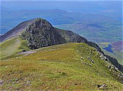
Caher West Top is a cool mountain in Ireland. It stands about 973.4 meters (3,194 feet) tall. Its name, Cathair na Féinne, means 'stone fort of the Fianna'. This mountain is the fifth-highest peak in Ireland. It's part of the amazing MacGillycuddy's Reeks mountain range in County Kerry. Caher West Top is special because it's known as a 'Furth'. We'll learn more about what that means!
Contents
Where is Caher West Top?

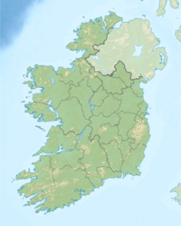
Caher West Top is found in County Kerry, in the southwest of Ireland. It's about 500 meters west of another peak called Caher East Top. Both are part of the famous MacGillycuddy's Reeks. This mountain range has many of Ireland's tallest peaks.
The Caher Ridge
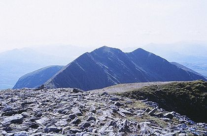
Climbers often talk about the Caher Ridge. This is a narrow path that runs along the top of Caher West Top. It continues to its neighbor, Caher Mountain. Walking along this ridge offers amazing views!
The Coombe Loughra Horseshoe
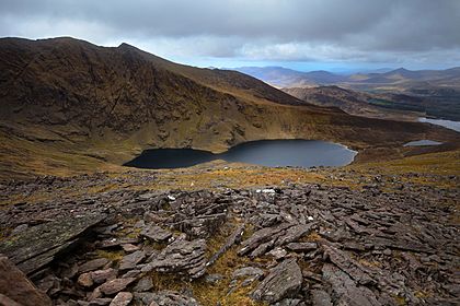
Many hikers climb Caher West Top as part of a longer adventure. This adventure is called the Coomloughra Horseshoe. It's a challenging but rewarding hike that takes 6-8 hours. People say it's one of Ireland’s best ridge walks.
This horseshoe trail includes several other peaks. You'll get to see Carrauntoohil, which is Ireland's highest mountain. Other peaks on the route are Beenkeragh, The Bones, Skregmore, and Cnoc Iochtair. It's a great way to explore the MacGillycuddy's Reeks!
What is a 'Furth' Mountain?
Caher West Top is special because it's one of 34 mountains called 'Furths'. The Scottish Mountaineering Club (SMC) created this list. A Furth is a mountain that is over 3,000 feet (about 914 meters) tall. It also meets other rules, like being separate enough from other peaks.
The word 'Furth' means 'outside of'. These mountains are outside of Scotland, but they are similar to Scotland's 'Munros'. That's why Caher West Top is sometimes called one of the 13 'Irish Munros'. It's the only Furth on the official SMC list that has a very small "prominence".
What is Prominence?
Prominence is a way to measure how much a mountain stands out. It's the height difference between a mountain's summit and the lowest point connecting it to a higher peak. Caher West Top has a very small prominence. This means it's very close to a higher mountain.
Because its prominence is so small, Caher West Top doesn't appear on some other mountain lists. These lists include the Irish Arderin classification. It also isn't on the British Isles Simm and Hewitt lists. It's also not in the 100 Highest Irish Mountains list. These lists usually require mountains to have a prominence of over 100 meters.

 | Kyle Baker |
 | Joseph Yoakum |
 | Laura Wheeler Waring |
 | Henry Ossawa Tanner |


