Caher Mountain (Kerry) facts for kids
Quick facts for kids Caher |
|
|---|---|
| Cathair na Féinne | |

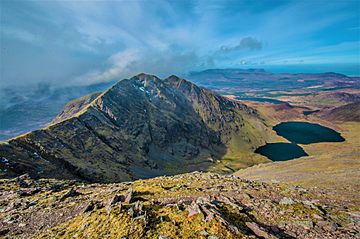
Caher Ridge, with Caher East Top (l) and Caher West Top (r); as seen from Carrauntoohil
|
|
| Highest point | |
| Elevation | 1,000 m (3,300 ft) |
| Prominence | 99.76 m (327.3 ft) |
| Listing | Furth, Hewitt, Arderin, Simm, Vandeleur-Lynam |
| Naming | |
| English translation | stone fort of the Fianna |
| Language of name | Irish |
| Geography | |
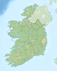
| Parent range | MacGillycuddy's Reeks |
| OSI/OSNI grid | V792838 |
| Topo map | OSI Discovery 78 |
| Geology | |
| Mountain type | Purple sandstone & siltstone, (Ballinskelligs Sandstone Formation) |
| Climbing | |
| Easiest route | via Coomloughra Horseshoe |
Caher, also known as Caher East Top, is a tall mountain in Ireland. It stands at 1,000 meters (about 3,281 feet) high. This makes it the third-highest mountain in the whole country! Caher is part of a famous mountain range called the MacGillycuddy's Reeks, which is located in County Kerry. Its name, Cathair na Féinne, means "stone fort of the Fianna" in the Irish language.
About Caher Mountain
Caher is Ireland's third-highest mountain peak. It is found in the southwest of Carrauntoohil, which is Ireland's highest mountain. Carrauntoohil is 1,038.6 meters (about 3,407 feet) tall. Both mountains are part of the MacGillycuddy's Reeks range in County Kerry.

Climbing Caher
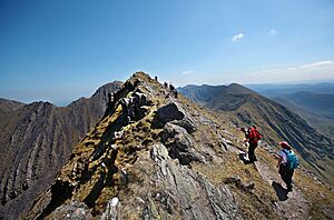
Many people enjoy climbing Caher. It is often part of a longer hiking route called the Coomloughra Horseshoe. This route usually takes 6 to 8 hours to complete. It is known as one of Ireland’s best ridge walks.
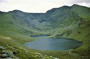
The Coomloughra Horseshoe trail goes around several nearby peaks. These include Caher West Top, Carrauntoohil, The Bones, Beenkeragh, and Skregmore. On the western side of Caher, there is a small area called Derrynafeana. Its name means "oak wood of the Fianna."
Hikers often talk about the Caher Ridge. This is a narrow path that runs along the top of Caher and its neighbor, Caher West Top.
Caher's Mountain Classifications
Mountains are often grouped into different lists based on their height and how much they rise above the land around them (called "prominence"). Caher is listed in several of these groups:
- Furth: The Scottish Mountaineering Club lists Caher as one of 34 "Furths." These are mountains over 3,000 feet (about 914 meters) tall that are outside of Scotland but meet other important criteria.
- Hewitt and Simm: Caher is also included in the British Isles' Hewitt and Simm classifications. These lists help climbers track different types of peaks.
- Arderin and Vandeleur-Lynam: In Ireland, Caher is recognized in the Arderin and Vandeleur-Lynam classifications. These are important lists for Irish mountains.
Caher's height and prominence mean it qualifies for these different mountain lists.

See also
 In Spanish: Cathair na Féinne para niños
 | Toni Morrison |
 | Barack Obama |
 | Martin Luther King Jr. |
 | Ralph Bunche |


