Calf Creek Plateau facts for kids
Quick facts for kids Calf Creek Plateau |
|
|---|---|

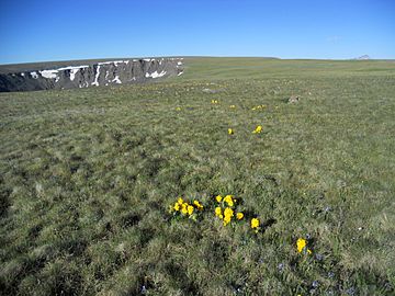
Calf Creek Plateau viewed from the northeast.
|
|
| Highest point | |
| Elevation | 12,661 ft (3,859 m) |
| Prominence | 909 ft (277 m) |
| Isolation | 6.45 mi (10.38 km) |
| Geography | |
| Location | Hinsdale County, Colorado, U.S. |
| Parent range | San Juan Mountains |
| Topo map | USGS 7.5' topographic map Powderhorn Lakes |
Calf Creek Plateau is a tall mountain in the northern San Juan Mountains. These mountains are part of the larger Rocky Mountains in North America. This amazing natural spot is found in Hinsdale County, Colorado, U.S..
Standing at 12,661 feet (3,859 m) high, Calf Creek Plateau is the highest point in the Powderhorn Wilderness. It's a great place for outdoor adventures and offers incredible views.
Contents
Discovering Calf Creek Plateau's Formation
Calf Creek Plateau is part of an ancient volcanic area called the San Juan volcanic field. This means the land here was shaped by volcanoes long ago. The mountain itself is made from lava flows. These lava flows are a type of rock called basalt.
These basalt rocks are from the Hinsdale Formation. Scientists believe they are about 16 to 19 million years old. They are some of the last volcanic rocks to form in this area. They are also very well-preserved. These old lava flows created a huge high-altitude area. Calf Creek Plateau and nearby Cannibal Plateau are the two highest parts of this area.
How Glaciers Shaped the Plateau
Long ago, Calf Creek Plateau was covered by glaciers. Glaciers are like giant, slow-moving rivers of ice. As they moved, they carved out big, bowl-shaped hollows in the mountain. These hollows are called cirques.
The biggest cirques on Calf Creek Plateau are on its north side. The beautiful Powderhorn Lakes are located in one of these cirques. These lakes are a popular spot for hikers to visit.
Hiking to the Summit of Calf Creek Plateau
Hiking to the top of Calf Creek Plateau is a rewarding adventure. The easiest way to reach the summit starts at the Powderhorn Lakes Trailhead. This trailhead is located at the northern edge of the wilderness area.
The Easiest Hiking Path
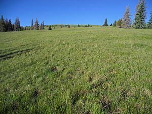
From the Powderhorn Lakes Trailhead, you can follow the Powderhorn Lakes Trail. You will walk southwest for about 1.4 miles (2.3 km). The trail then reaches a large, open meadow. Here, the trail turns southeast towards Powderhorn Lakes.
Instead of following the trail to the lakes, you will leave the trail. Continue walking up the ridge for about 3.0 miles (4.8 km). You will walk through meadows first. Then, you will reach the alpine tundra, which is a treeless area high up in the mountains. Finally, you will arrive at the wide summit of Calf Creek Plateau. The views along this high-altitude hike are truly amazing! The climb on this route goes up about 1,500 feet (457 m).
Other Ways to Reach the Plateau
There are other trails that can take you to Calf Creek Plateau. You can start from the Devil’s Creek Trailhead to the west. Or, you can use the Deer Lakes, Brush Creek, and Powderhorn Park trailheads to the south. All these routes begin in forests. They then open up into the beautiful, high-altitude landscape of the Powderhorn Wilderness.
 | Precious Adams |
 | Lauren Anderson |
 | Janet Collins |


