
California Historical Landmarks in San Diego County facts for kids
Welcome to a journey through time in San Diego County, California! This amazing area in Southern California is home to many special places called California Historical Landmarks. These landmarks are important spots that tell us stories about the past, from early explorers and settlers to famous buildings and events.
Imagine stepping back in time to see where people lived long ago, where important battles happened, or even where a famous roller coaster first thrilled riders! These landmarks help us understand how San Diego County grew and changed over hundreds of years. Let's explore some of these cool historical treasures!
Contents
Historic Buildings and Homes
San Diego County has many old buildings and homes that are now protected as historical landmarks. They show us what life was like in different eras.
Adobe Chapel of The Immaculate Conception
The Adobe Chapel of The Immaculate Conception is a very old chapel located at 3950 Conde St. in San Diego. It's a beautiful example of early California architecture, showing how people built structures with adobe bricks. This chapel has seen many years of history in San Diego.

Casa de Estudillo
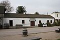
The Casa de Estudillo, found at 4000 Mason St. in San Diego, is one of the oldest surviving houses in Old Town San Diego State Historic Park. It was built in 1827 by José María Estudillo. This large adobe house gives us a peek into the life of a wealthy family during California's Mexican period. It's a great place to imagine what homes looked like almost 200 years ago.

Whaley House
The Whaley House, located at 2482 San Diego Ave. in Old Town, is another fascinating old home. Built in 1857 by Thomas Whaley, it served as a family home, a general store, San Diego's second county courthouse, and even a theater. It's known for its unique history and the many roles it played in the early days of San Diego.

Gaskill Brothers' Stone Store
In the town of Campo, you can find the Gaskill Brothers' Stone Store on State Hwy 94. This sturdy stone building, also known as Gaskill’s Brothers Stone Store, was built in the late 1800s. It was an important trading post and store for the community, especially during the time when people were settling in this part of California.

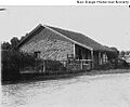
Hubert H. Bancroft Ranch House
The Hubert H. Bancroft Ranch House is located in Spring Valley. This ranch was once home to Hubert Howe Bancroft, a famous historian who collected many important documents and books about the history of the American West. His ranch house is a reminder of his important work in preserving history.

Hotel del Coronado
The Hotel del Coronado, at 1500 Orange Ave. in Coronado, is a grand and famous hotel built in 1888. It's known for its beautiful Victorian architecture and has hosted many presidents, celebrities, and even been featured in movies. It's a stunning example of a historic resort by the sea.

Important Missions and Early Settlements
San Diego County is where California's mission system began, and there are several important sites related to early Spanish settlement.
Mission San Diego de Alcalá
The Mission San Diego de Alcalá, located at 10818 San Diego Mission Rd. in San Diego, was the very first of the 21 California missions. Founded in 1769 by Father Junípero Serra, it marked the beginning of European settlement in California. It's a place of great historical and religious importance.

Mission San Luis Rey de Francia
Further north, in Oceanside, is the Mission San Luis Rey de Francia at 4050 Mission Ave. Founded in 1798, it became the largest of all the California missions. It's often called the "King of the Missions" because of its size and importance.

San Antonio de Pala Asistencia
The San Antonio de Pala Asistencia, or Pala Mission, is a branch of Mission San Luis Rey de Francia. Located in Pala, it was established in 1816 to serve the Native American communities in the inland areas. It's unique because it's the only California mission outpost that still serves its original purpose as a mission for Native Americans.

Presidio of San Diego
The Presidio of San Diego was the first European settlement on the West Coast of the United States. Located in San Diego, it was a military fort and a mission founded in 1769. Today, Presidio Park marks the site where this important settlement once stood, overlooking the city.

Cool Transportation and Engineering Feats
Some landmarks celebrate how people traveled and built amazing things.
The Berkeley Ferryboat
Docked at 1306 North Harbor Dr. in San Diego, the Berkeley is a historic ferryboat. Launched in 1898, it was one of the first propeller-driven ferries on San Francisco Bay. It's a wonderful example of early 20th-century marine engineering and a reminder of how people traveled across water before bridges were common.

The Star of India Ship
Right next to the Berkeley at 1306 North Harbor Dr. in San Diego is the magnificent Star of India. This iron-hulled sailing ship was built in 1863, making it the oldest active sailing ship in the world! It sailed around the globe 21 times, carrying passengers and cargo. It's an incredible piece of maritime history.

Giant Dipper Roller Coaster
For something a bit more thrilling, the Giant Dipper roller coaster at 3190 Mission Blvd. in San Diego is a California Historical Landmark! Built in 1925, this wooden roller coaster is still operating today at Belmont Park. It's a classic example of early amusement park rides and continues to bring joy to many.
Old Mission Dam
The Old Mission Dam, located in Mission Trails Regional Park in San Diego, is an impressive engineering marvel from the past. Built by the Kumeyaay people and Spanish missionaries in the early 1800s, this dam helped provide water to Mission San Diego de Alcalá. It shows how early settlers managed water resources.

Natural Wonders and Battlefields
San Diego County also protects sites that highlight its natural beauty and important historical conflicts.
Cabrillo National Monument
At Point Loma in San Diego, you'll find the Cabrillo National Monument. This monument commemorates the landing of Juan Rodríguez Cabrillo in 1542, who was the first European explorer to set foot on the West Coast of the United States. It offers amazing views of the Pacific Ocean and San Diego Bay.

Old Point Loma Lighthouse
Within the Cabrillo National Monument in San Diego stands the Old Point Loma Lighthouse. Built in 1855, this lighthouse guided ships into San Diego Bay for many years. It's a charming historical building that tells the story of maritime navigation in the past.

San Pasqual Battlefield State Historic Park
The San Pasqual Battlefield State Historic Park in Escondido marks the site of the Battle of San Pasqual in 1846. This was one of the most important battles during the Mexican-American War in California. The park helps us remember the soldiers who fought there and understand this significant event in California's history.

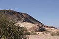
Anza-Borrego Desert State Park Landmarks
Anza-Borrego Desert State Park is California's largest state park and contains several historical landmarks related to early trails and expeditions.
- Borrego Sink (also known as San Gregorio) was an important watering hole for travelers.
- Box Canyon was a challenging part of the Butterfield Overland Mail Route, a famous stagecoach route that carried mail and passengers across the country in the 1850s.
- El Vado was a campsite for the Anza expedition in 1775, a group of Spanish explorers who opened a land route to California.
- Palm Spring and Santa Catarina Springs were vital water sources in the desert for both Native Americans and early travelers.
These desert landmarks remind us of the tough journeys people made to explore and settle California.


Images for kids
-
Ballast Point Whaling Station, an early whaling site.
-
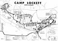
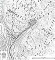
A map showing Camp Lockett, a historic military camp.
-
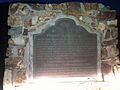
A historical marker for Camp Wright.
-
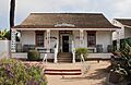
The historic Casa de Bandini, now the Cosmopolitan Hotel.
-
The Casa de Carrillo house in 1908.
-
The site of the former Casa de Cota house in Old Town.
-
The Casa de Lopez in Old Town San Diego.
-
The Casa de Machado y Silvas in Old Town.
-
The Casa de Pedrorena de Altamirano.
-
The Casa de Machado y Stewart, also known as Casa de Stewart.
-
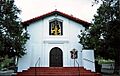
The Chapel of Santa Ysabel.
-
An image representing the era of Congress Hall, demolished in 1939.
-
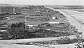
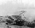
The San Diego River and Derby Dike in 1905.
-
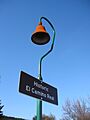
A marker for El Camino Real, the historic mission trail.
-
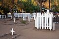
El Campo Santo, a historic cemetery.
-
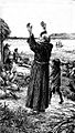
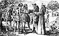
An illustration of Serra in San Diego, representing El Desembarcadero.
-
The Exchange Hotel, lost in an 1872 fire.
-
A map of Ballast Point from 1851, near Fort Guijarros.
-
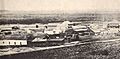
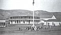
Fort Rosecrans barracks.
-
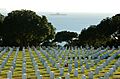
Fort Rosecrans National Cemetery.
-
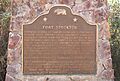
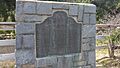
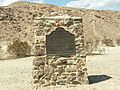
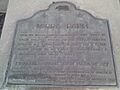
A plaque marking the Fort Stockton site.
-
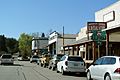
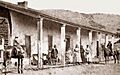
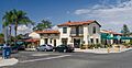
A street view of the historic district of Julian.
-
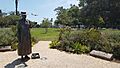
A statue of Kate O. Sessions, a famous horticulturist.
-
La Cristianita Canyon, where the first Christian baptism in California took place.
-
A map from the US Boundary Survey, near La Playa.
-
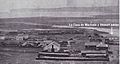
San Pedro Chapel at Las Flores Estancia.
-
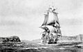
The San Carlos entering San Francisco Bay, representing La Punta De Los Muertos.
-
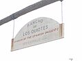
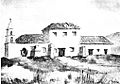
Leo Carrillo Ranch, also known as Rancho de los Kiotes.
-
Ocotillo Wells, near Los Puertecitos.
-
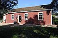
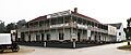
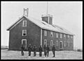
The Mason Street School Museum.
-
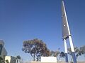
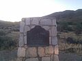
The Montgomery Memorial.
-
Mule Hill, a historic battlefield.
-
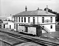
The National City Santa Fe Rail Depot.
-
The Oak Grove Butterfield Stage Station.
-
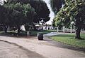
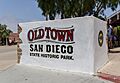
A view of Old Town San Diego State Historic Park.
-
A sign for the Pedro Fages Trail.
-
The Peg Leg Smith Monument.
-
The Plaza San Diego Viejo, also called Plaza de Las Armas.
-
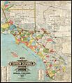
A map of Southern California Ranchos, including Rancho Cañada de los Coches.
-
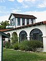
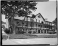
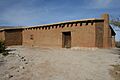
The Rancho Guajome Adobe Ranch House.
-
A street view of Rancho Santa Fe.
-
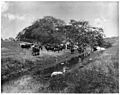
Cattle grazing at Rancho Santa Margarita y Las Flores.
-
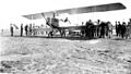
Carrying passengers at Rockwell Field.
-
The San Diego Barracks.
-
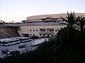
The historic Aztec Bowl, now Viejas Arena at San Diego State University.
-
The San Felipe-Butterfield Stage Station.
-
The Serra Palm in Presidio Park.
-
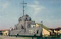
The USS Recruit, a landlocked training ship.
-
Vallecito Station.
-
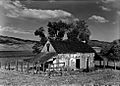
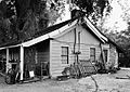
The Ranch House at Warner's Ranch.


,_Old_Town_--_2012_--_5517.jpg)


.jpg)
.jpg)


.jpg)
.jpg)

_is_now_the_site_of_Viejas_Arena.JPG)


.jpg)
See also
