
National Register of Historic Places listings in San Diego County, California facts for kids

This article is about the amazing historic places in San Diego County, California, that are listed on the National Register of Historic Places. This special list helps protect buildings, sites, and objects that are important to the history of the United States.
San Diego County has 154 places on this list, including 17 that are extra special and called National Historic Landmarks. These places tell us stories about the past, from ancient times to more recent history. Let's explore some of them!
Contents
Exploring San Diego's Historic Places
The National Register of Historic Places includes all sorts of cool spots. Some are old buildings, some are beautiful parks, and some are even ships! Protecting these places helps us learn about how people lived long ago and what events shaped our world.
Famous Parks and Landmarks
San Diego County is home to several well-known historic parks and landmarks that are important to its past.
- Balboa Park: This huge park in San Diego is famous for its beautiful Spanish-style buildings, gardens, and museums. It became a National Historic Landmark because of its unique architecture and its role in two big world's fairs.

- Cabrillo National Monument: Located at the tip of Point Loma, this monument remembers Juan Rodríguez Cabrillo, the first European to explore the West Coast of the United States in 1542. It also has an old lighthouse that used to guide ships.

- Chicano Park: Found under the Coronado Bridge in San Diego, this park is famous for its colorful murals painted on the bridge pillars. It's a National Historic Landmark because it represents the Chicano Civil Rights Movement and the community's fight for a park.

- Old Mission Dam: This dam, built by Native Americans and Spanish missionaries, is one of the oldest water systems in California. It helped bring water to the Mission San Diego de Alcalá and is a National Historic Landmark.

Historic Homes and Buildings
Many old houses and buildings in San Diego County are on the National Register because of their unique architecture or the important people who lived in them.
- Hubert H. Bancroft Ranchhouse: This historic ranch house in Spring Valley belonged to Hubert Howe Bancroft, a famous historian who wrote many books about the American West. It's a National Historic Landmark.
.jpg)
- Casa de Estudillo: Located in Old Town San Diego, this adobe house was built in 1827. It's one of the oldest surviving Spanish colonial homes in California and a National Historic Landmark.

- Hotel Del Coronado: This beautiful Victorian hotel in Coronado opened in 1888. It's famous for its unique wooden architecture and has hosted many presidents and celebrities. It's also a National Historic Landmark.

- Villa Montezuma: This grand Victorian mansion in San Diego was built in 1887 for musician Jesse Shepard. It's known for its fancy design and unique features, making it a very special historic home.
.jpg)
- Rancho Guajome Adobe: Located near Vista, this large adobe ranch house was built in the 1850s. It shows what life was like on a big rancho during California's early days and is a National Historic Landmark.

Important Ships
San Diego's history is closely tied to the ocean, and some historic ships are also on the National Register.
- Berkeley (ferryboat): This old ferryboat, built in 1898, used to carry passengers across San Francisco Bay. Now, it's part of the Maritime Museum of San Diego and is a National Historic Landmark.

- Star of India (ship): This magnificent tall ship, built in 1863, is the world's oldest active sailing ship. It has sailed around the world many times and is also part of the Maritime Museum, recognized as a National Historic Landmark.

Other Unique Historic Sites
Beyond buildings and ships, the National Register includes other interesting places that tell San Diego's story.
- Old Town San Diego Historic District: This area is where the first European settlement in California began. It includes many historic buildings that show what San Diego was like in the early 1800s.

- Gaslamp Quarter Historic District: This lively area in downtown San Diego has many Victorian-era buildings. It was once a busy commercial and entertainment district in the late 1800s.

- Mission San Diego de Alcalá: This was the first of the 21 California missions, founded in 1769. It played a big role in the early history of California. It is a National Historic Landmark.

- Mission San Luis Rey de Francia: Located in Oceanside, this mission was founded in 1798 and is the largest of all the California missions. It's also a National Historic Landmark.

- Torrey Pines Gliderport: This site has been used for gliding and flying since the 1930s. It's still a popular spot for paragliding and hang gliding today, offering amazing views of the coast.

Images for kids
-
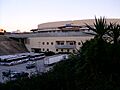
The Aztec Bowl stadium, formerly listed.

See also
 In Spanish: Anexo:Registro Nacional de Lugares Históricos en el condado de San Diego para niños
