
Campo, California facts for kids
Quick facts for kids
Campo, California
|
|
|---|---|

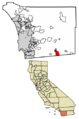
Location of Campo in San Diego County, California.
|
|

Campo, California
Location in California

Campo, California
Location in the United States
|
|
| Country | |
| State | |
| County | |
| Area | |
| • Total | 23.51 sq mi (60.89 km2) |
| • Land | 23.50 sq mi (60.88 km2) |
| • Water | 0.01 sq mi (0.02 km2) 0.03% |
| Elevation | 2,802 ft (854 m) |
| Population
(2020)
|
|
| • Total | 2,955 |
| • Density | 125.72/sq mi (48.54/km2) |
| Time zone | UTC-8 (Pacific (PST)) |
| • Summer (DST) | UTC-7 (PDT) |
| ZIP codes |
91906
|
| Area code(s) | 619 |
| FIPS code | 06-10508 |
| GNIS feature ID | 2582962 |
Campo is a small community in southeastern San Diego County, California. Its name means "Field" in Spanish. It is an unincorporated community, which means it's not officially a city. In 2020, about 2,955 people lived there.
Campo includes three smaller areas: Campo, Cameron Corners, and Morena Village. Cameron Corners is about 1 mile (1.6 km) north of Campo. Morena Village is a few miles further north, near Lake Morena. All these areas use the same postal address and ZIP Code 91906.
Contents
History of Campo: A Look Back
Campo has an interesting past. A large dam called Morena Dam was built nearby between 1896 and 1912. This dam helped provide water to the San Diego area.
In 1919, a railway line called the San Diego and Arizona Railway was finished, and Campo became one of its stations.
Campo During World War II
During World War II, Campo was an important military town. It was known as Camp Lockett. This camp had a hospital for soldiers recovering from injuries. It also had a camp for war prisoners from Italy in Cameron Corners.
An all African-American Buffalo Soldiers Cavalry unit was also stationed here. These soldiers patrolled the border on horseback until 1944. Today, the United States Military still has activities nearby at the La Posta Mountain Warfare Training Facility.
Geography and Location
Campo is located about 50 miles (80 km) southeast of San Diego. It covers an area of about 23.5 square miles (60.7 km2). Most of this area is land, with only a tiny bit of water.
Nearby Communities
Several other communities are close to Campo. These include Boulevard, Potrero, Tecate, Dulzura, Jacumba, Pine Valley, Mount Laguna, Descanso, and Jamul.
Campo's Climate
Campo has a hot-summer Mediterranean climate. This means it has hot, dry summers and cool, somewhat wet winters. The temperature can change a lot between day and night throughout the year.
| Climate data for Campo, California (1991–2020 normals, extremes 1950–present) | |||||||||||||
|---|---|---|---|---|---|---|---|---|---|---|---|---|---|
| Month | Jan | Feb | Mar | Apr | May | Jun | Jul | Aug | Sep | Oct | Nov | Dec | Year |
| Record high °F (°C) | 85 (29) |
89 (32) |
92 (33) |
99 (37) |
103 (39) |
110 (43) |
111 (44) |
108 (42) |
110 (43) |
103 (39) |
94 (34) |
86 (30) |
111 (44) |
| Mean maximum °F (°C) | 77.7 (25.4) |
78.1 (25.6) |
83.4 (28.6) |
89.7 (32.1) |
94.4 (34.7) |
100.6 (38.1) |
104.2 (40.1) |
104.2 (40.1) |
100.8 (38.2) |
94.1 (34.5) |
85.7 (29.8) |
78.7 (25.9) |
106.0 (41.1) |
| Mean daily maximum °F (°C) | 63.6 (17.6) |
64.0 (17.8) |
67.9 (19.9) |
72.6 (22.6) |
78.8 (26.0) |
87.7 (30.9) |
93.9 (34.4) |
95.1 (35.1) |
90.3 (32.4) |
80.2 (26.8) |
70.9 (21.6) |
63.2 (17.3) |
77.4 (25.2) |
| Daily mean °F (°C) | 49.2 (9.6) |
49.5 (9.7) |
52.1 (11.2) |
55.3 (12.9) |
60.6 (15.9) |
66.5 (19.2) |
73.4 (23.0) |
74.6 (23.7) |
70.0 (21.1) |
61.4 (16.3) |
53.9 (12.2) |
48.3 (9.1) |
59.6 (15.3) |
| Mean daily minimum °F (°C) | 34.7 (1.5) |
35.0 (1.7) |
36.3 (2.4) |
38.1 (3.4) |
42.4 (5.8) |
45.2 (7.3) |
53.0 (11.7) |
54.2 (12.3) |
49.7 (9.8) |
42.6 (5.9) |
37.0 (2.8) |
33.4 (0.8) |
41.8 (5.4) |
| Mean minimum °F (°C) | 22.2 (−5.4) |
23.2 (−4.9) |
26.6 (−3.0) |
27.6 (−2.4) |
32.1 (0.1) |
35.8 (2.1) |
40.6 (4.8) |
40.9 (4.9) |
37.1 (2.8) |
30.7 (−0.7) |
25.7 (−3.5) |
22.0 (−5.6) |
19.6 (−6.9) |
| Record low °F (°C) | 10 (−12) |
12 (−11) |
15 (−9) |
20 (−7) |
25 (−4) |
29 (−2) |
34 (1) |
30 (−1) |
29 (−2) |
22 (−6) |
16 (−9) |
12 (−11) |
10 (−12) |
| Average precipitation inches (mm) | 3.09 (78) |
3.45 (88) |
2.28 (58) |
1.04 (26) |
0.38 (9.7) |
0.09 (2.3) |
0.29 (7.4) |
0.42 (11) |
0.40 (10) |
0.67 (17) |
1.03 (26) |
2.44 (62) |
15.58 (396) |
| Average snowfall inches (cm) | 0.1 (0.25) |
0.0 (0.0) |
0.0 (0.0) |
0.1 (0.25) |
0.0 (0.0) |
0.0 (0.0) |
0.0 (0.0) |
0.0 (0.0) |
0.0 (0.0) |
0.0 (0.0) |
0.0 (0.0) |
0.1 (0.25) |
0.3 (0.75) |
| Average precipitation days (≥ 0.01 in) | 6.9 | 7.8 | 6.6 | 4.7 | 2.0 | 0.4 | 1.6 | 1.7 | 2.1 | 2.5 | 4.5 | 7.1 | 47.9 |
| Average snowy days (≥ 0.1 in) | 0.0 | 0.0 | 0.1 | 0.0 | 0.0 | 0.0 | 0.0 | 0.0 | 0.0 | 0.0 | 0.0 | 0.0 | 0.1 |
| Source: NOAA | |||||||||||||
People Living in Campo
| Historical population | |||
|---|---|---|---|
| Census | Pop. | %± | |
| 2010 | 2,684 | — | |
| 2020 | 2,955 | 10.1% | |
| U.S. Decennial Census | |||
In 2010, about 2,684 people lived in Campo. By 2020, this number grew to 2,955. Most people in Campo are White, and many are also of Latino background. There are also African American, Native American, and Asian residents.
Most people in Campo live in families. About 37% of households have children under 18. The average household has about 2.77 people. The average family size is about 3.27 people.
The population includes people of all ages. About 30% are under 18, and about 10% are 65 or older. The median age is around 35 years old. This means half the people are younger than 35, and half are older.
What to See and Do in Campo
Campo is home to several interesting places to visit.
Museums in Campo
You can explore three museums in Campo:
- The Pacific Southwest Railway Museum: This museum is all about trains and railways.
- The Motor Transport Museum: Here, you can see different types of vehicles.
- The Gaskill Brothers' Stone Store: This historic store shows what life was like in the past.
Local Services and Facilities
Campo has a fire station run by the CDF. There's also a county road maintenance station and another county fire station.
Major employers in the area include the US Department of Homeland Security Border Patrol. The San Diego County, California Probation department also has a Juvenile Ranch Facility here.
Campo is also near the start of the Pacific Crest Trail. This is a very long hiking and horseback riding trail. It stretches for about 2,650 miles (4,265 km) all the way north to the Canada-US border.
Transportation in Campo
Campo is located along the old Southern Pacific railway line. Today, the Pacific Southwest Railway Museum operates passenger train rides on part of this line. The museum is located at 750 Depot Street.
There is also a private airstrip nearby. It is about 4.2 miles (6.8 km) north of Campo.
Native American Tribal Areas
Near Campo, there are at least two tribal areas that are part of the Campo Indian Reservation. One area is about 1.5 miles (2.4 km) north of Campo, next to Cameron Corners. The government for this area is the Campo Band of Mission Indians.
Another tribal area is about 7 miles (11 km) east along State Route 94. This larger area includes the community of Live Oak Springs. The tribal government has even provided wireless internet service to its members using a special microwave network.
Schools in Campo
Campo has several schools for students of different ages:
- Rancho Del Campo High School - for older students (grades 9-12)
- Campo Elementary School - for younger students (grades K-8)
- Campo Continuation - another option for students
- Hillside Alternative Junior/Senior High - for middle and high school students (grades 7-12)
- Cottonwood Community Day - for middle and high school students (grades 7-12)
- Mountain Empire Junior/Senior High - for middle and and high school students (grades 7-12)
Campo Elementary (K-6) is also located in Cameron Corners, which is considered part of Campo for postal services.
Images for kids
-
Location of Campo in San Diego County, California.
See also
 In Spanish: Campo (California) para niños
