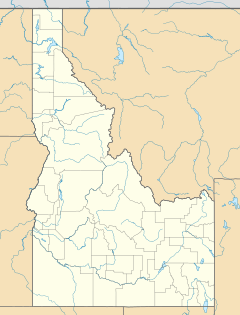
Camas County Highpoint facts for kids
Quick facts for kids Camas County Highpoint |
|
|---|---|
| Highest point | |
| Elevation | 10,337 ft (3,151 m) |
| Prominence | 240 ft (73 m) |
| Geography | |
| Location | Blaine and Camas counties, Idaho, U.S. |
| Parent range | Smoky Mountains |
| Topo map | USGS Galena |
| Climbing | |
| Easiest route | Simple scramble, class 2 |
Camas County Highpoint is a special mountain peak in Idaho. It's the highest point in Camas County and the second tallest peak in the beautiful Smoky Mountains. Imagine standing on top of the world in that area! This peak reaches an amazing 10,337 feet (3,151 m) above sea level. It sits right on the edge of two counties, Blaine and Camas, and is also part of the Sawtooth National Recreation Area and the Fairfield Ranger District of Sawtooth National Forest. It's located about 0.6 miles (970 m) south-southwest of Saviers Peak, which is the highest point in the Smoky Mountains.
Exploring Camas County Highpoint
Camas County Highpoint is a significant mountain in Idaho. It's known for being the highest spot in Camas County. People who enjoy climbing mountains often try to reach the highest point in different areas, like counties or states. This is a fun challenge for many outdoor adventurers.
What is a County Highpoint?
A county highpoint is simply the highest natural elevation within a specific county. For Camas County, this peak is the tallest place you can stand. Reaching these highpoints is a popular hobby for hikers and climbers. It allows them to explore different parts of a region and see amazing views.
The Smoky Mountains Range
Camas County Highpoint is part of the Smoky Mountains. This mountain range is located in central Idaho. The Smoky Mountains are known for their rugged beauty and are a part of the larger Rocky Mountains system. They offer stunning landscapes with forests, valleys, and rocky peaks.
How High is the Peak?
Camas County Highpoint stands at 10,337 feet (3,151 m) above sea level. To give you an idea, that's taller than many famous buildings! This elevation means the peak often has snow for much of the year, even into summer. The air also gets thinner at such high altitudes.
What is Prominence?
The peak also has a "prominence" of 240 feet (73 m). Prominence is a way to measure how much a peak stands out from the land around it. It tells you how high you have to go down from the peak before you start climbing up to another, higher peak. A higher prominence means the mountain looks more impressive and distinct.
Location and Nearby Areas
Camas County Highpoint is located in a very scenic part of Idaho. It's right on the border between Blaine and Camas counties. This means you can be in two places at once when you're at the top!
Sawtooth National Recreation Area
The peak is also on the border of the Sawtooth National Recreation Area. This is a huge area managed by the United States Forest Service. It was created to protect the natural beauty of the Sawtooth and White Cloud Mountains. It also provides opportunities for people to enjoy the outdoors.
What Can You Do There?
The Sawtooth National Recreation Area is a fantastic place for outdoor activities. You can go hiking, camping, fishing, and wildlife watching. In winter, people enjoy skiing and snowmobiling. It's a place where nature is protected, but people are still welcome to explore and have fun.
Sawtooth National Forest
Camas County Highpoint is also part of the Fairfield Ranger District of Sawtooth National Forest. National Forests are large areas of land managed for many uses. These include timber production, wildlife habitat, and recreation. They are important for keeping our environment healthy.
Exploring the Forest
Within the Sawtooth National Forest, you can find many trails for hiking and backpacking. There are also places for camping and picnicking. It's a great place to learn about different types of trees, plants, and animals that live in the mountains.
Reaching the Summit
The easiest way to reach the top of Camas County Highpoint is described as a "simple scramble."
What is Scrambling?
Scrambling is a type of climbing that's more difficult than hiking but not as hard as rock climbing. It usually involves using your hands to help you balance and move over rocky or steep terrain. It's like climbing a very steep hill where you might need to grab onto rocks or roots to pull yourself up. The difficulty rating for this peak is class 2, which means it's a relatively easy scramble.
Safety While Scrambling
When scrambling, it's important to wear good hiking boots and be careful where you place your hands and feet. Always go with someone experienced if you're new to scrambling. The views from the top are often worth the effort!
 | Jackie Robinson |
 | Jack Johnson |
 | Althea Gibson |
 | Arthur Ashe |
 | Muhammad Ali |


