Camden (CDP), Maine facts for kids
Quick facts for kids
Camden, Maine
|
|
|---|---|

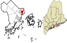
Location in Knox County and the state of Maine
|
|
| Country | |
| State | Maine |
| County | Knox |
| Town | Camden |
| Area | |
| • Total | 3.77 sq mi (9.76 km2) |
| • Land | 3.77 sq mi (9.75 km2) |
| • Water | 0.00 sq mi (0.01 km2) |
| Elevation | 26 ft (8 m) |
| Population
(2020)
|
|
| • Total | 3,850 |
| • Density | 1,022.58/sq mi (394.87/km2) |
| Time zone | UTC-5 (Eastern (EST)) |
| • Summer (DST) | UTC-4 (EDT) |
| ZIP codes |
04843, 04847
|
| Area code(s) | 207 |
| FIPS code | 23-09690 |
| GNIS feature ID | 0563374 |
Camden is a charming village located in the beautiful state of Maine, United States. It's part of a larger area also called Camden, found in Knox County. This village is known as a census-designated place (CDP), which means it's a special area identified by the census bureau.
In 2020, about 3,850 people lived in this village part of Camden. The entire town of Camden has a slightly larger population.
Contents
Exploring Camden's Location
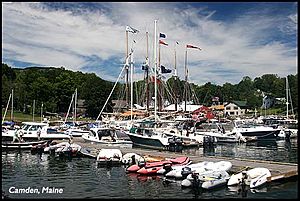
Camden village is situated in the southeastern part of the town of Camden. It's a scenic spot where the Megunticook River flows into the lovely Penobscot Bay. Imagine a river meeting the sea!
Key Boundaries and Features
The village stretches south towards the town of Rockport. To the west, it reaches Simonton Road and Cobb Road. To the north, you'll find Mount Battie Road and Beloin Road. The eastern edge of the village follows the beautiful coastline of Penobscot Bay.
A famous landmark here is Mount Battie. This mountain is about 790 feet tall. It's part of Camden Hills State Park and offers amazing views. Mount Battie is actually located within the village area.
Getting Around Camden
U.S. Route 1 is a major road that goes right through the center of Camden village. If you head north on this route, you'll reach Belfast in about 18 miles. Going south for about 8 miles will take you to Rockland.
Other important roads include Maine State Route 52 (Mountain Street) and Maine State Route 105 (Washington Street). These roads lead northwest out of the village. Route 52 goes about 7 miles to Lincolnville Center. Route 105 leads about 6 miles to Hope.
Size of the Village
According to the United States Census Bureau, the village area covers about 3.77 square miles (or 9.8 square kilometers). All of this area is land, meaning there are no large bodies of water within the village's official boundaries.
Who Lives in Camden?
The population of Camden village has changed over the years.
| Historical population | |||
|---|---|---|---|
| Census | Pop. | %± | |
| 2020 | 3,850 | — | |
| U.S. Decennial Census | |||
In the year 2000, there were 3,934 people living in the village. These people lived in 1,826 households. A household can be a family or individuals living together.
Community Life
About 22.8% of households in 2000 had children under 18 living with them. Many households (45.7%) were married couples. Also, a good number of people (18.6%) lived alone and were 65 years old or older. The average household had about two people.
Age Groups
The population in 2000 was spread across different age groups.
- About 18.7% of the people were under 18 years old.
- Around 25.8% were 65 years old or older.
- The median age was 48 years. This means half the people were younger than 48 and half were older.
See also
In Spanish: Camden (condado de Knox) para niños
 | Valerie Thomas |
 | Frederick McKinley Jones |
 | George Edward Alcorn Jr. |
 | Thomas Mensah |


