Camira, Queensland facts for kids
Quick facts for kids CamiraIpswich, Queensland |
|||||||||||||||
|---|---|---|---|---|---|---|---|---|---|---|---|---|---|---|---|

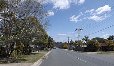
Addison Road, 2014
|
|||||||||||||||
| Population | 7,415 (2021 census) | ||||||||||||||
| • Density | 927/km2 (2,400/sq mi) | ||||||||||||||
| Postcode(s) | 4300 | ||||||||||||||
| Area | 8.0 km2 (3.1 sq mi) | ||||||||||||||
| Time zone | AEST (UTC+10:00) | ||||||||||||||
| Location | 25 km (16 mi) from Brisbane CBD | ||||||||||||||
| LGA(s) | City of Ipswich | ||||||||||||||
| State electorate(s) | Jordan | ||||||||||||||
| Federal Division(s) | Oxley | ||||||||||||||
|
|||||||||||||||
Camira is a suburb located in the City of Ipswich, Queensland, Australia. It's a place where about 7,415 people live, according to the 2021 census.
Contents
Where is Camira?
Camira is found about 25 kilometers (that's about 15 miles) away from the center of Brisbane CBD. It's also quite close to another suburb called Springfield Lakes.
A Look at Camira's History
What Does the Name Camira Mean?
The name Camira comes from an Aboriginal word. This word means "windy," which might give you a clue about the weather there sometimes!
When Did Camira State School Open?
A big part of Camira's history is its school. Camira State School first opened its doors on January 29, 1974.
How Many People Live in Camira?
The number of people living in Camira has been quite steady over the years.
- In 2011, there were 7,391 people.
- By 2016, the population was 7,414.
- In 2021, it was 7,415 people.
Learning in Camira
Camira State School
Camira State School is a government primary school. It teaches students from Prep (the first year of school) all the way up to Year 6. You can find the school at 184-202 Old Logan Road.
In 2018, the school had 617 students. It also had 42 teachers and 30 other staff members who help the school run smoothly. The school also has a special program to support students with different learning needs.
Community Services
Mobile Library Service
The Ipswich City Council helps the community by running a special service. They have a mobile library that visits the community center every two weeks. This means you can borrow books and other materials right in your neighborhood!
 | George Robert Carruthers |
 | Patricia Bath |
 | Jan Ernst Matzeliger |
 | Alexander Miles |


