Canela, Chile facts for kids
Quick facts for kids
Canela
|
||||||
|---|---|---|---|---|---|---|

Canela Baja
|
||||||
|
||||||
| Country | ||||||
| Region | ||||||
| Province | Choapa | |||||
| Named for | Quechua: sun sparkling | |||||
| Capital | Canela Baja | |||||
| Government | ||||||
| • Type | Municipality | |||||
| Area | ||||||
| • Total | 2,196.6 km2 (848.1 sq mi) | |||||
| Elevation | 295 m (968 ft) | |||||
| Population
(2012 Census)
|
||||||
| • Total | 9,182 | |||||
| • Density | 4.1801/km2 (10.8264/sq mi) | |||||
| • Urban | 1,744 | |||||
| • Rural | 7,635 | |||||
| Demonym(s) | Canelino/a | |||||
| Sex | ||||||
| • Men | 4,737 | |||||
| • Women | 4,642 | |||||
| Time zone | UTC-4 (CLT) | |||||
| • Summer (DST) | UTC-3 (CLST) | |||||
| Area code(s) | 56 + 53 | |||||
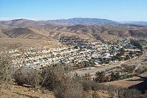
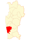
Canela is a special area in Chile, located in the north-central Coquimbo Region. It is one of four "communes" in the Choapa Province. Think of a commune like a local district or a small county. The main town and capital of Canela is called Canela Baja. The name Canela comes from a Quechua word meaning "sun sparkling."
How Canela is Governed
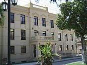
Canela is managed by a municipal council. This council is led by an alcalde, who is like a mayor. The people of Canela vote directly for their alcalde. The main building for the local government, called the alcaldía, is in Canela Baja.
Since 2012, the alcalde of Canela has been Juan Bernardo Leyton Lemus. He works with six councilors who help make decisions for the commune. These councilors are:
- Manuel Ángel Navarro Vega
- Ana Margarita Vega Flores
- Miguel Pereira Bugueño
- Darwin Cortés Palma
- Néstor Valle Tapia
- Gustavo Gallardo Trigo
Canela is also part of larger government groups in Chile. It belongs to an "electoral district" and a "Senate District." This means that people from Canela help choose representatives for the National Congress. These representatives work in two main groups: the Chamber of Deputies and the Senate. They help make laws for the whole country.
Where is Canela?
Canela covers a large area of about 2,196.6 square kilometers. It has the Pacific Ocean to its west. To the north, it shares borders with three other communes: Ovalle, Punitaqui, and Combarbalá. To the southeast, you'll find the commune of Illapel, and to the south is Los Vilos. The town of Canela Baja is about 12 kilometers east of the main highway, Route 5.
Canela's Weather
The climate in Canela is described as steppe or semiarid. This means it's often dry, but it does get some rain. The average rainfall each year is about 169.51 millimeters. The water from the Canela stream flows into the Choapa River, which then goes into the Pacific Ocean.
People of Canela
In 2002, a count of the population showed that Canela had 9,379 people living there. Most of these people, about 81.4%, lived in rural areas, which are like the countryside. The remaining 18.9% lived in urban areas, which are towns. Canela's population makes up a small part of the total population of the Coquimbo Region.
See also
 In Spanish: Canela (Chile) para niños
 | Madam C. J. Walker |
 | Janet Emerson Bashen |
 | Annie Turnbo Malone |
 | Maggie L. Walker |


