Choapa Province facts for kids
Quick facts for kids
Choapa Province
Provincia de Choapa
|
|||||
|---|---|---|---|---|---|
|
|||||
| Country | |||||
| Region | Coquimbo | ||||
| Capital | Illapel | ||||
| Comunas | Illapel, Salamanca, Los Vilos, Canela | ||||
| Government | |||||
| • Type | Provincial | ||||
| Area | |||||
| • Total | 10,131.6 km2 (3,911.8 sq mi) | ||||
| Population
(2002 Census)
|
|||||
| • Total | 81,681 | ||||
| • Density | 8.06200/km2 (20.88049/sq mi) | ||||
| Time zone | UTC-4 (CLT) | ||||
| • Summer (DST) | UTC-3 (CLST) | ||||
| Area code(s) | 56 + 53 | ||||
| Website | Official website: http://www.gobernacionchoapa.gov.cl/ | ||||
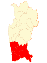
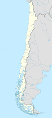
Choapa Province (which is called Provincia de Choapa in Spanish) is a special part of Chile. It's one of three provinces located in the Coquimbo Region. Think of it like a big county within a larger state! The main city and capital of Choapa Province is Illapel.
Contents
Where is Choapa Province?
Choapa Province covers an area of about 10,131.6 square kilometers. To give you an idea, that's roughly the size of a small country! It's the smallest province in the Coquimbo Region.
This province has some interesting neighbors. To the north, you'll find the Limarí Province. To the east, it shares a border with Argentina, a country known for its amazing mountains. To the south, it's next to the Valparaíso Region of Chile. And to the west, it meets the vast Pacific Ocean.
 |
Limarí province |  |
||
| Pacific Ocean | Argentina | |||
| Valparaíso region |
How Many People Live Here?
According to a national count in 2002, there were 81,681 people living in Choapa Province. This means that for every square kilometer, there were about 8.1 people.
The biggest city in the province is Illapel, which is also its capital. In 2002, about 30,355 people lived in Illapel.
How is Choapa Province Managed?
Choapa Province is a second-level administrative division in Chile. This means it's a way the country is divided up to help manage things. It's made up of four smaller areas called communes.
The city of Illapel is the capital, which means it's where the main offices for the province are located. The province is led by a governor, who helps make sure everything runs smoothly for the people living there.
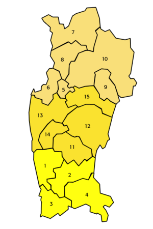
Here's a quick look at the communes in Choapa Province:
| Code | Commune | Capital | Area (km²) |
Population (2002) |
|---|---|---|---|---|
| 04201 | 2 Illapel | Illapel | 2,629.1 | 30,355 |
| 04202 | 1 Canela | Canela | 2,196.6 | 4,379 |
| 04203 | 3 Los Vilos | Los Vilos | 1,860.6 | 17,453 |
| 04204 | 4 Salamanca | Salamanca | 3,445.3 | 24,494 |
| Total for Choapa Province | 10,131.6 | 81,681 | ||
See also
 In Spanish: Provincia de Choapa para niños
 | Madam C. J. Walker |
 | Janet Emerson Bashen |
 | Annie Turnbo Malone |
 | Maggie L. Walker |


