
Salamanca, Chile facts for kids
Quick facts for kids
Salamanca
|
||||||
|---|---|---|---|---|---|---|
 |
||||||
|
||||||
| Country | ||||||
| Region | ||||||
| Province | Choapa | |||||
| Founded by | Joaquín de Ceballo | |||||
| Government | ||||||
| • Type | Municipality | |||||
| Area | ||||||
| • Total | 3,445.3 km2 (1,330.2 sq mi) | |||||
| Elevation | 632 m (2,073 ft) | |||||
| Population
(2012 Census)
|
||||||
| • Total | 25,326 | |||||
| • Density | 7.35088/km2 (19.0387/sq mi) | |||||
| • Urban | 12,689 | |||||
| • Rural | 11,805 | |||||
| Sex | ||||||
| • Men | 13,043 | |||||
| • Women | 11,451 | |||||
| Time zone | UTC−4 (CLT) | |||||
| • Summer (DST) | UTC−3 (CLST) | |||||
| Area code(s) | 56 + 53 | |||||
| Website | Municipality of Salamanca | |||||
.svg)
.svg)


Salamanca is a city and a commune (a small local area) in Chile. It is located in the Choapa Province within the Coquimbo Region. Salamanca is about 30 kilometers (19 miles) east of Illapel, which is the main town of the province. It is also about 316 kilometers (196 miles) north of Santiago, Chile, the capital city.
Most people reach Salamanca from Los Vilos, a town near the Pan-American Highway. This highway connects Salamanca to the rest of Chile. The city sits on the north side of the Choapa River, in the beautiful Choapa valley. Joaquín de Ceballo, who was the governor of Illapel, officially founded Salamanca in 1844. The city also has a small airport called Las Brujas Airport.
Contents
History of Salamanca


The city of Salamanca was officially founded on November 29, 1844. It was established by Joaquín Ceballos, who was the acting governor of Illapel. The land for the city came from the Hacienda Choapa, a large estate. At that time, the Hacienda Choapa was owned by a charity.
Before the charity, the estate belonged to Matilde Salamanca. After she passed away, the Church managed her property starting in 1820. Then, in 1821, Bernardo O'Higgins, a leader of Chile, decided that the land should be used for public good.
Salamanca was built on the north bank of the Choapa river. It was close to an old Native American settlement in a place now known as Chalinga. By 1897, Salamanca had grown to about 2,000 people. Chalinga was a smaller village with 367 residents. Salamanca had a church, a telegraph office, and a civil registration office. It also became the main seat for the local government, overseeing areas like Peralillo and Cerro Chico.
Many of the large farms that were part of the Choapa estate were divided into smaller plots after 1928. Even in 1959, the Hacienda Choapa still covered a huge area of 253,000 hectares (about 625,000 acres). Only a small part, just over 8,000 acres, was used for farming with irrigation.
In the late 1960s, a program helped people living in rural parts of the Choapa Valley move into villages along the Choapa River. This helped create more organized urban areas by 1982.
Ancient People of Salamanca
The area around Salamanca has been home to people for a very long time, even since the last Ice Age. Human groups arrived here over 10,000 years ago. This town is also known for old stories about it being a "witch city," with tales about local figures like Jose Maria Olguin.
Early Human Settlements

Between 8000 and 2500 BC, groups of hunter-gatherers lived in these lands. They moved from the coast to find food. Over time, these groups slowly started to farm, especially growing corn. They also continued to hunt animals like guanacos.
Around 300 BC to 200 AD, new groups of people arrived in the valley. These people were farmers and made pottery, and they came from northwestern Argentina. We know this from the first archaeological finds in places like St. Augustine, Grove, Chillepín, Panguesillo, and Salamanca.
The Molle Culture
The Molle people lived in the valleys and canyons. They farmed and raised animals. They knew a little about working with gold, silver, and copper metals. They made simple pottery and used tobacco or similar plants. They also wore a special lip ornament made of stone called a tembetá. We don't have a lot of information about this culture, but it seems they were not a major group in this specific area.
The Diaguita Culture
It is thought that the Diaguitas came to Chile around the 10th century. They traveled from northwestern Argentina, crossing mountains and settling in the valleys of North Chico. The Diaguita groups in the valley mainly hunted, farmed, and raised animals. They lived in semi-permanent or permanent villages.
The Diaguitas were skilled at making pottery, which they decorated with detailed geometric patterns. Their pottery improved even more when the Incas arrived. Their political system was unique, with "dual lordships." This meant their lands were divided into two parts, each led by a chief. One part was near the coast, and the other was in the mountains or the "upper" part of the valley, where the Choapa Valley Diaguitas lived.
Many petroglyphs (rock carvings) in the valley are thought to be from the Diaguita culture. These stones and boulders with signs and drawings were a way for them to record important events or information. You can find famous petroglyphs in Panguesillo, Chillepín, Jorquera, Santa Rosa, Cerro Chico, and Salamanca.
Inca Rule in Chile
The Inca ruler Tupac Inca Yupanqui (who ruled from 1471 to 1493) is known for conquering the southern areas. This expanded the Tahuantinsuyo into the Diaguita lands. A general named Sinchiruca led an expedition with over ten thousand soldiers. They fought for six years between Copiapo and Aconcagua. Some historians believe the Inca rule in this area lasted about 50 to 75 years, until the Spanish arrived.
The Inca invasion left its mark on the Choapa region. The Incas taught people better ways to farm. They also showed them how to build roads and irrigation canals. They improved the production of textiles, pottery, and various household items. After the Inca invasion, the Inca Trail, a famous road, passed through the Cordilleran area of Petorca into central Chile.
This same road was used by Diego de Almagro (in 1536) and Pedro de Valdivia (in 1540) to enter the Aconcagua Valley and the Mapocho River Valley. It's interesting that parts of this "Inca road" still exist. It was built to help with military travel, trade, and communication for the Inca Empire. This road was part of a huge network of twenty thousand kilometers (about 12,400 miles) of paths through mountains and valleys. Many parts of it are known in the Alicahue and Petorca valleys. In 1984, a section leading to Cuncumén and Conchuca was found. There are also signs that a coastal Inca Trail existed, which might have passed through La Serena, Illapel, and Ligua.
Population of Salamanca
According to the 2002 census by the National Statistics Institute, Salamanca covers an area of about 3,445.3 square kilometers (1,330.2 square miles). It had 24,494 residents at that time. Out of these, 13,043 were men and 11,451 were women.
About 12,689 people (51.8%) lived in urban areas (cities and towns). The other 11,805 people (48.2%) lived in rural areas (countryside). The population of Salamanca grew by 5.9% (1,368 people) between the 1992 and 2002 censuses.
How Salamanca is Governed

Salamanca is a commune, which is a local administrative area in Chile. It is managed by a municipal council. The head of this council is an alcalde (mayor), who is chosen by the people in an election every four years. The mayor from 2008 to 2012 was Gerardo Rojas Escudero, who belonged to the PPD.
The council members during that time were:
- Pedro Chávez González
- Roberto Rondanelli Hidalgo
- Rubén Sacre Barlaro
- Omar Alamos Calderón
- Carlos Rojas Tapia
- Enrique Tapia
For national elections, Salamanca is part of the 9th electoral district for the Chamber of Deputies. This district also includes other communes like Combarbalá, Punitaqui, Monte Patria, Illapel, Los Vilos, and Canela. The commune is represented in the Senate as part of the 4th senatorial constituency, which covers the entire Coquimbo Region.
Panorama

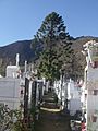
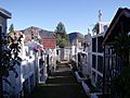
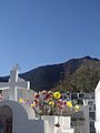
Municipal Cemetery Salamanca
-
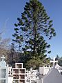
Municipal Cemetery Salamanca
-
-
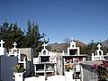
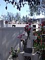
Municipal Cemetery Salamanca (Right)
-
-
-

.JPG)

.JPG)
_12.JPG)


Gallery
-
-
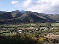
The village of Chuchiñi
-
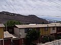
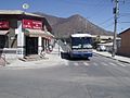
Neighborhoods in Salamanca
-
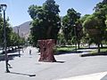
Plaza de Aguirre
.JPG)


See also
 In Spanish: Salamanca (Chile) para niños
