Canton of Redange facts for kids
Quick facts for kids
Canton of Redange
Kanton Réiden
|
||
|---|---|---|
|
||
 |
||
| Country | Luxembourg | |
| Legislative constituency | Nord | |
| LAU 1 | LU00003 | |
| Capital | Redange-sur-Attert | |
| Communes (cities in bold) |
Beckerich Ell Grosbous Préizerdaul Rambrouch Redange Saeul Useldange Vichten Wahl |
|
| Area | ||
| • Total | 267.5 km2 (103.3 sq mi) | |
| Area rank | 2nd of 12 | |
| Highest elevation | 554 m (1,818 ft) | |
| Lowest elevation | 232 m (761 ft) | |
| • Rank | 9th of 12 | |
| • Density rank | 9th of 12 | |
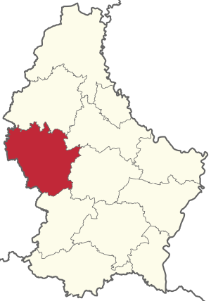
The Canton of Redange is a region in the northwest of Luxembourg. It is one of the 12 cantons in the country. Its main town and capital is Redange, also known as Redange-sur-Attert. This canton shares borders with other cantons in Luxembourg and with Belgium to the west.
Contents
Exploring the Geography of Redange
The Canton of Redange sits right where two main types of landscapes in Luxembourg meet. It has both hilly areas and flatter plains.
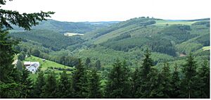
The Oesling Mountains
To the north, you'll find the Oesling mountain range. This area is part of the larger Ardennes region. It has many hills covered in thick forests. These hills are usually between 400 and 500 meters (about 1,300 to 1,600 feet) above sea level. The highest point in the canton is Napoléonsgaard, which is 554 meters (1,818 feet) high.
This region also has deep valleys. Rivers and streams have carved these valleys over time. The Sauer and Wark are two important rivers here. Part of the Upper Sûre Lake reservoir is also in the Canton of Redange.
The Oesling part of the canton includes towns like Rambrouch, Wahl, and Grosbous. Some parts of Ell, Redange, and Préizerdaul are also in this hilly region.
The Gutland Plains
To the south, the landscape changes to the Gutland plain. This area is much lower, averaging around 300 meters (about 980 feet) above sea level.
Here, you'll see wide, shallow river valleys. There are fewer forests compared to the north. The most important river in this southern part is the Attert.
Towns like Beckerich, Saeul, Useldange, and Vichten are located in the Gutland part of the canton.
Towns and Transport
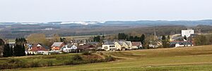
The Canton of Redange is mostly a rural area. This means it has more countryside than big cities. The largest town with over 1,000 people is Redange-sur-Attert, which is the capital. Most of the important services are in Redange. You can find a secondary school, supermarkets, and a retirement home there.
Along the border with Belgium, there are many gas stations. People often visit these for cheaper fuel. Towns like Haut-Martelange and Oberpallen are known for this.
Getting Around
The Canton of Redange does not have its own train stations.
However, it is well-connected by roads. National roads like the N12 pass through the canton. This road links Luxembourg City to Wiltz, and Arlon (in Belgium) to Ettelbruck. The canton also has a good public bus system. This bus network is part of Luxembourg's general public transport.
Local Towns and Villages
The Canton of Redange is made up of ten different local areas called communes. Think of them like small towns or districts.
| Beckerich | Grosbous | Rambrouch | Saeul | Vichten |
| Ell | Préitzerdaul | Redange | Useldange | Wahl |
Over the years, some of these communes have joined together. For example, in 1979, four smaller communes merged to create the commune of Rambrouch. Also, the towns of Grosbous and Wahl voted to merge in 2021. They will form a new commune called Groussbus-Wal in 2023.
A Look Back in Time: History of Redange
People have lived in the Canton of Redange for a very long time, since ancient times.
Roman Times
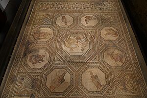
One of the most exciting finds from the Gallo-Roman period is a large mosaic. It was discovered in 1994 in Vichten, in the eastern part of the canton.
This mosaic is about 10 meters (33 feet) long and 6 meters (20 feet) wide. It was part of the floor in the entrance of a Roman country house, called a villa rustica. The mosaic shows the nine muses (goddesses of arts and sciences) and the Greek poet Homer. It was likely made around the year 240 AD.
Many other ancient sites have been found in the canton. These include places like Rippweiler, Hovelange, and Schandel.
The Middle Ages
During the Middle Ages, the area of the Canton of Redange was part of the Duchy of Luxembourg. It was ruled by many different lords and counts. These rulers lived in castles scattered across the canton. Even today, you can find the ruins of these old castles. The most famous one is Useldange castle.
The French Revolution and the Canton's Start
When the French Revolution happened, the Duchy of Luxembourg became part of the French Republic. It was called the Département des Forêts. In 1796, this department was divided into 26 cantons. One of these was the canton of Ospern. Its borders were very similar to today's Redange canton. The main difference was the border with Belgium, which was set in 1839.
Later, in 1841, the capital of the canton was moved from Ospern to Redange.
The Industrial Age
Towards the end of the 17th century, people started digging for slate near Haut-Martelange and Rombach. These places are in the northwest of the canton.
The slate mines became very important after a family from Frankfurt, the Rothers, invested in them. In 1890, a railway line connected Haut-Martelange to Noerdange. This made it possible to send large amounts of slate all over Europe.
During this time, the slate mines in Haut-Martelange produced a lot of Luxembourg's exports. They also provided many jobs for people in the area. These underground mines became some of the most important slate producers in Europe.
However, slate mining stopped in 1986. This happened after the last person from the Rother family, Christiane Rother, passed away in 1985.
Population Growth
The chart above shows how the population of the Canton of Redange has changed over many years. You can see that the number of people living here has grown quite a lot, especially in recent decades.
See also
 In Spanish: Cantón de Redange para niños
 | Jackie Robinson |
 | Jack Johnson |
 | Althea Gibson |
 | Arthur Ashe |
 | Muhammad Ali |


