Castelltallat range facts for kids
Quick facts for kids Castelltallat Range |
|
|---|---|
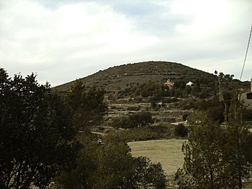
El Tossal, Castelltallat's highest summit
|
|
| Highest point | |
| Elevation | 887 m (2,910 ft) |
| Geography | |
| Location | Bages, Solsonès, Catalonia |
| Parent range | Catalan Central Depression |
| Geology | |
| Mountain type | Limestone and marl |
| Climbing | |
| First ascent | Unknown |
| Easiest route | From Sant Mateu de Bages |
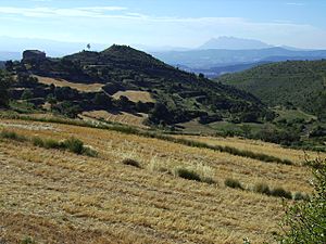
The Castelltallat range (in Catalan: Serra de Castelltallat) is a group of hills in central Catalonia, Spain. It sits between two areas called comarcas: Bages and Solsonès. This mountain range covers about 65 square kilometers.
It's one of the hills that stands alone in the Catalan Central Depression. You can find it at the southwestern edge of this depression.
Contents
What is the Castelltallat Range Like?
The Castelltallat range is made mostly of limestone and marl rocks. These mountains stretch from the southwest to the northeast. The highest point is called "El Tossal," which is 936 meters tall.
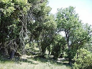
The northern sides of the mountains are steep and covered in forests. The southern sides are not as steep, so people use them for farming.
Villages and History
Most of the mountain range is part of the town of Sant Mateu de Bages. A smaller part is in the towns of Pinós and La Molsosa. The village of Castelltallat used to be its own town until 1840. Then it became part of Sant Mateu de Bages.
The old church of Sant Miquel has been around since 1031. It sits high up at 887 meters. This church shows different building styles from history. You can see parts that are Romanesque, Renaissance, Baroque, and neoclassical.
The church was built near the ruins of an old castle. This castle was built in the 10th or 11th century. The mountain range gets its name from this castle. "Castell talaiat" means "castle" (Castell) and "watchtower" (Talaia).
What is the Climate Like?
The Castelltallat range has a Submediterranean climate. This means it has warm, dry summers and mild, wet winters. The average temperature for the whole year is about 12 °C.
January is the coldest month, with an average of 3.5 °C. July and August are the warmest, averaging 21.5 °C. The area gets about 600 liters of rain each year. There is usually very little or no snow. Most of this mountain range is a protected area. It is part of a plan by the government of Catalonia to protect natural places.
Animals and Plants
Before big wildfires in 1994 and 1998, many pine trees grew here. These included Pinus nigra, Pinus halepensis, and Pinus sylvestris. There were also some Pinus pinea trees.
After the fires, new trees started to grow. Now, you can mostly see Quercus humilis and Quercus ilex (holm oak) trees. In areas without forests, you'll find meadows. These meadows have plants like Aphyllantion or Brachypodium.
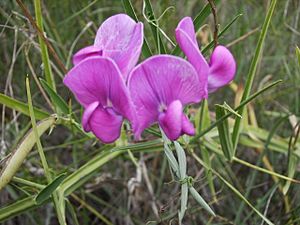
There are also many shrubs, especially Dorycnum pentaphyllum and rosemary. A special plant called ruac (Ononis tridentata) grows in small patches of gypsum rock. You might also find bastard balm (Melittis melissophyllum). Other interesting plants include yellow foxglove (Digitalis lutea), Primulas (Primula acaulis), and broom (Genista cinerea).
Wildlife in the Range
The wildfires did not seem to affect the birds much. The Eurasian eagle-owl (Bubo bubo) is the largest bird that nests here. For a few years now, you can also see griffon vultures (Gyps fulvus) flying overhead. They come from the nearby area of upper Solsonès. The number of partridges has also stayed about the same after the fires.
Among the wild mammals, the number of wild boars and foxes is growing. However, the number of rabbits changes a lot.
The Astronomical Observatory
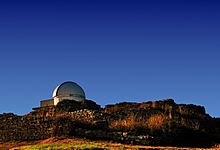
An astronomical observatory was built near the old castle ruins. This was done to help bring new life to the area after many forest fires. The observatory opened in 2004.
Its dome is 5 meters across, and the telescope inside is 400 mm. It's a great place to look at the stars!
See also
 In Spanish: Sierra de Castelltallat para niños
 | Jessica Watkins |
 | Robert Henry Lawrence Jr. |
 | Mae Jemison |
 | Sian Proctor |
 | Guion Bluford |


