Castlereagh (borough) facts for kids
Quick facts for kids Castlereagh Borough
|
|
|---|---|
 |
|
| Area | 85 km2 (33 sq mi) Ranked 24th of 26 |
| Population | 67,272 (2011 census) |
| • Density | 791/km2 (2,050/sq mi) |
| District HQ | Upper Galwally, Newtownbreda |
| Catholic | 22.2% |
| Protestant | 67.9% |
| Country | Northern Ireland |
| Sovereign state | United Kingdom |
| EU Parliament | Northern Ireland |
| Councillors |
|
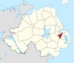
Castlereagh (/ˈkɑːsəlreɪ/ KAH-səl-ray) was a special area in Northern Ireland that used to manage its own local affairs. It was called a "borough," which is a type of town or district with special rights. In May 2015, Castlereagh joined with Lisburn City Council. Together, they became the Lisburn and Castlereagh City Council. A small part of Castlereagh also became part of Belfast City Council.
Castlereagh was mostly a city-like area. It included many suburbs, which are smaller towns or areas just outside a big city like Belfast. These suburbs were located in the Castlereagh Hills, southeast of Belfast. There was also a small countryside area in the south. Unlike many places, Castlereagh didn't have one main town center. Its biggest population areas were Carryduff, about 9.6 kilometers (6 miles) south of Belfast, and Dundonald, about 8 kilometers (5 miles) east.
The name Castlereagh comes from an old area called a "barony" of the same name. This barony was named after a specific piece of land, also called Castlereagh. The name itself comes from the Irish words An Caislean Riabhach, which means "Grey Castle." This refers to an old castle that belonged to the O'Neils, a powerful family long ago. The castle was near where an Orange hall stands today on Church Road.
Contents
How Castlereagh Was Formed
The Castlereagh district was created on October 1, 1973. It was one of 26 new districts set up at that time. It was made by combining several areas from County Down. These included most of the old Castlereagh Rural District, plus parts of the Hillsborough Rural District (like Carryduff and Newtownbreda) and the Moneyreagh area from the North Down Rural District.
Running the Borough: The Council
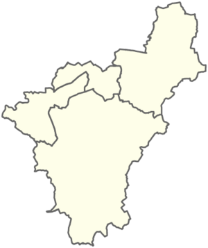
The borough was split into four voting areas: Castlereagh Central, South, East, and West. In the elections held in 2011, 23 people were chosen to be members of the council.
As of February 2012, the council had members from several political parties:
- 11 from the Democratic Unionist Party (DUP)
- 6 from the Alliance Party
- 3 from the Ulster Unionist Party (UUP)
- 2 from the Social Democratic and Labour Party (SDLP)
- 1 from the Green Party
The last election was supposed to happen in May 2009. However, the government decided to delay it until new councils were formed in 2011. The plans for these new councils changed, so the most recent local elections for Castlereagh happened in 2011.
Who Was the Mayor?
In 1977, Castlereagh District Council was given a special document called a "royal charter." This document officially made the district a borough and created the important job of mayor. The mayor is like the leader or head of the council.
For the year 2013–2014, the mayor of Castlereagh was Councillor David Drysdale from the DUP. The Deputy Mayor, who helps the mayor, was Councillor Ann-Marie Beattie, also from the DUP.
Representing Castlereagh
People living in Castlereagh were represented in different parts of the government. For elections to the Westminster Parliament (the main government in the UK), the borough was divided into three areas:
- The East Belfast constituency covered many wards like Ballyhanwood, Dundonald, and Tullycarnet.
- The South Belfast constituency included wards such as Beechill, Carryduff, and Newtownbreda.
- The Strangford constituency covered the Moneyreagh ward.
These same areas were also used for elections to the Northern Ireland Assembly, which is the local government for Northern Ireland.
Elections in 2011
The 2011 elections brought big changes to Castlereagh's political scene. The DUP party lost two council seats, meaning they no longer had complete control of the council. The UUP also lost one of their representatives.
On the other hand, the Alliance Party gained two seats, and the Green Party gained one. There were no changes in the West or South areas of the borough.
What About the Population?
According to the 2011 Northern Ireland census, the area that used to be Castlereagh Borough Council had a population of 67,272 people.
Special Honors: Freedom of the Borough
The "Freedom of the Borough" is a very special honor given to people or groups who have done great things for the area. It's a way for the borough to show its thanks and respect.
Individuals Honored
- George Best: A famous football player, honored in 2002.
- Peter Robinson: A well-known politician, honored in 2003.
Military Units Honored
Several military and service groups also received this honor:
- The Ulster Defence Regiment: 1984.
- The Ulster Special Constabulary Association: 1992.
- The Regimental Association of the Ulster Defence Regiment: 1994.
- The Royal Irish Regiment: 1995.
- The Royal British Legion: 1996.
- The 204 (North Irish) Field Hospital Royal Army Medical Corps (Volunteers): 1998.
- The Royal Ulster Constabulary GC: 2000.
- The Northern Ireland Prison Service: 2004.
- The 152 (North Irish) Regiment RLC (Volunteers): 25 May 2013.
- The 152 Royal Electrical and Mechanical Engineers Workshops: 25 May 2013.
- The Police Service of Northern Ireland: December 2014.
 | Claudette Colvin |
 | Myrlie Evers-Williams |
 | Alberta Odell Jones |


