Castleton (CDP), Vermont facts for kids
Quick facts for kids
Castleton, Vermont
|
|
|---|---|

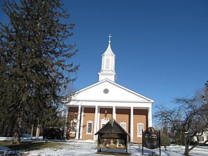
St. John the Baptist Church
|
|
| Country | United States |
| State | Vermont |
| County | Rutland |
| Town | Castleton |
| Area | |
| • Total | 1.27 sq mi (3.29 km2) |
| • Land | 1.26 sq mi (3.27 km2) |
| • Water | 0.008 sq mi (0.02 km2) |
| Elevation | 439 ft (134 m) |
| Population
(2020)
|
1,337 |
| • Density | 1,059/sq mi (408.9/km2) |
| Time zone | UTC-5 (Eastern (EST)) |
| • Summer (DST) | UTC-4 (EDT) |
| ZIP Code |
05735
|
| Area code(s) | 802 |
| FIPS code | 50-11875 |
| GNIS feature ID | 2586622 |
|
Castleton Village Historic District
|
|
| Location | Irregular pattern along Main and South Sts., Castleton, Vermont |
|---|---|
| Area | 71 acres (29 ha) |
| Built | 1777 |
| Architect | Multiple |
| Architectural style | Greek Revival, Federal, Late Victorian |
| NRHP reference No. | 79000225 |
| Added to NRHP | April 26, 1979 |
Castleton is a main village in the town of Castleton, Vermont. It's located in Rutland County, in the United States. In 2020, about 1,337 people lived in the village. The entire town of Castleton had 4,458 residents.
A big part of Castleton village is known as the Castleton Village Historic District. This area was added to the National Register of Historic Places in 1979 because of its important history. Castleton is also home to Castleton University. This university started in 1787 and is now part of the Vermont State Colleges system.
Contents
Where is Castleton?
Castleton Village is in the western part of Rutland County. It sits on the south side of the Castleton River. The village is about halfway between Rutland, Vermont, and Whitehall, New York.
Main Street runs through the village from east to west. This road is also known as Vermont Route 4A. Another highway, U.S. Route 4, runs east to west on the north side of the river. The center of the village is where North Road and South Street meet.
Vermont Route 30 is the main north-south road in the town. It is located west of the village in an area called Castleton Four Corners. Castleton also has an active train line. This line runs north of Main Street and carries the Amtrak Ethan Allen Express train. The train stops at the station at the east end of the village.
Castleton's History
Castleton Village was first settled in the early 1770s. Main Street was created in 1772 as the main road for travel in the area.
Revolutionary War Events
In 1775, an important event happened here. Ethan Allen gathered the Green Mountain Boys in the village. They were preparing for the Capture of Fort Ticonderoga. This was an early battle in the American Revolutionary War.
Education and Growth
Castleton University was founded in 1787. Later, the Castleton Medical College started in 1818. Both of these schools were located on the south side of Main Street.
In the 1800s, the town became very successful. This was thanks to the marble and slate industries. The building of two railroad lines in the 1850s also helped the town grow.
Tourism and Changes
Around the early 1900s, tourism became popular. People visited Lake Bomoseen in the summer. This led to new hotels and other services being built.
However, a series of fires in the 1910s caused a lot of damage. Many important buildings were destroyed. Most of the village was added to the National Register of Historic Places in 1979. This was to protect its special 19th-century buildings.
See also
 In Spanish: Castleton (condado de Rutland) para niños
 | Selma Burke |
 | Pauline Powell Burns |
 | Frederick J. Brown |
 | Robert Blackburn |


