Castor Bay facts for kids
Quick facts for kids
Castor Bay
|
|
|---|---|
|
Suburb
|
|
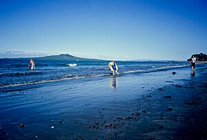
Castor Bay beach
|
|
| Country | New Zealand |
| Local authority | Auckland |
| Electoral ward | North Shore ward |
| Local board | Devonport-Takapuna Local Board |
| Area | |
| • Land | 144 ha (356 acre) |
| Population
(June 2023)
|
|
| • Total | 4,490 |
| Postcode(s) |
0620
|
|
|
||
Castor Bay is a lovely bay and a suburb on the North Shore in Auckland, New Zealand. It's located on the North Island between two other suburbs, Milford and Campbells Bay. This area is part of what's known as the East Coast Bays. From Castor Bay, you can easily see the beautiful islands of Rangitoto and Motutapu out in the Hauraki Gulf. The suburb is managed by the Auckland Council as part of the North Shore ward.
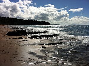
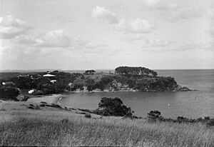
The bay itself is quite small and is protected by a special wall called a breakwater. This wall helps keep the water calm. Near the beach, there's a grassy area with big pōhutukawa trees, which are famous for their bright red flowers. These trees offer nice shade, and the coastline stretches out towards Campbells Bay.
Contents
Exploring Castor Bay's Landscape
Castor Bay is found on the eastern side of the North Shore. It sits right between Campbells Bay to the north and Milford to the south. The bay shares its name with the suburb and offers views of Rangitoto. A notable spot to the east of Castor Bay is Rahopara Point. At the southern edge of the suburb, you'll find a small river called Wairau Creek.
The land in Castor Bay is mostly made up of clay and a type of rock called Waitemata sandstone. You can see these layers in the cliffs along the coast. Before people settled here, the inland areas of Castor Bay were covered in thick forests. These forests had huge trees like kauri, tōtara, mataī, miro, and kahikatea. Along the coastline, many Pōhutukawa trees grew, adding to the natural beauty.
Castor Bay's Rich History
Early Māori Life
Māori people first arrived in the Auckland Region a long time ago, around the 13th or 14th centuries. The North Shore was home to Tāmaki Māori tribes. These groups were skilled at fishing and gathering shellfish, which were important food sources.
A powerful warrior named Maki came to the Auckland area in the 17th century. He united many local tribes, forming a large group called Te Kawerau ā Maki. After Maki passed away, his sons took over different parts of his lands. His younger son, Maraeariki, settled the North Shore. Maraeariki's daughter, Kahu, later became a leader. The North Shore is sometimes called Te Whenua Roa o Kahu, meaning "The Greater Lands of Kahu," in her honor. Many of today's local tribes, like Ngāti Manuhiri and Ngāi Tai Ki Tāmaki, can trace their family lines back to Kahu.
The northern headland of Castor Bay was once a Māori pā (a fortified village or stronghold) called Rahopara. It was also known as Te Rahopara o Peretū. Scientists have found evidence of an ancient earth oven there, dating back to the 15th or 16th centuries. Over many generations, the defenses of this pā were improved. Rahopara was a strong defensive site for Te Kawerau ā Maki. Another pā, Wairoa Pā, was located further south, overlooking Wairau Creek.
By the 18th century, another group, the Marutūāhu iwi Ngāti Paoa, had grown their influence to include the islands in the Hauraki Gulf and the North Shore. Peace was generally established by the 1790s. When Europeans first arrived in the late 18th century, many Māori sadly became sick from new diseases. In the early 1820s, many Māori from the North Shore moved away to avoid conflicts during the Musket Wars. However, most had returned by the late 1820s and 1830s.
European Settlement and Development
In 1841, the Crown bought a large area of land that included Castor Bay. This purchase involved some Māori tribes, but not all of them. The government worked until 1873 to make sure all tribes with a claim to the land were included in the agreements.
Castor Bay was originally called Castor Oil Bay. This was because an early settler planted castor bean trees on the hillsides. The shorter name, Castor Bay, started being used around the 1910s. Around the same time, the Castor Oil Bay Land Company began dividing the land into smaller sections for homes.
By the early 1900s, Castor Bay became a popular spot for people to visit for a day trip or a holiday. Many small holiday homes, called baches, were built here. In the 1920s, the bay became a favorite place for New Zealand writers. A resident named Jane Stronach let poets like D'Arcy Cresswell and R. A. K. Mason, and novelist Jane Mander, use her bach.
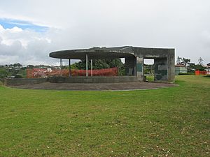
During World War II, a military base called the Castor Bay Battery and Camp was built. Its job was to protect the Rangitoto Channel. The army bought the land in 1934. The military buildings were cleverly disguised to look like regular houses. The base was closed in 1957. In 1966, the land was given to the local council and became the JF Kennedy Memorial Park, which you can visit today.
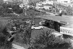
After the Auckland Harbour Bridge was built in 1959, Castor Bay grew even more. The first local shops opened, making life more convenient for residents. In 1965, the ancient Rahopara pā site was almost destroyed. There were plans to dig up the earthworks to use as fill for a new marina. However, archaeologists and local people worked together to stop this, saving the important historical site.
Castor Bay Today: Population and Education
Castor Bay covers about 1.44 square kilometers. As of 2023, it has an estimated population of around 4,800 people. This means there are about 3,300 people living in each square kilometer.
At the 2018 census, Castor Bay had 4,509 residents. This was a small increase from previous years. There were 1,563 households. The median age was 42.0 years. About 18% of the people were under 15 years old, and 15.7% were 65 or older.
Most residents (76.2%) are of European background. Other groups include 3.9% Māori, 1.2% Pacific peoples, and 21.5% Asian. Many people (39.5%) were born outside New Zealand.
When asked about religion, 54.2% said they had no religion. About 35.7% were Christian, and smaller numbers followed other religions like Hinduism, Islam, and Buddhism.
Many adults in Castor Bay have a university degree or higher (39.2%). The median income was $46,600. Most adults (51.3%) worked full-time.
Local School
The main local school for younger students is Campbells Bay Primary School. It's located on Aberdeen Road, close to the Pupuke Golf Course. The school opened in 1925 and currently has over 1,200 students.
Famous People from Castor Bay
- Sam Hunt: He is one of New Zealand's most famous poets and was born in Castor Bay.
- Robin Hyde: A well-known New Zealand poet who was born in South Africa.
 | William M. Jackson |
 | Juan E. Gilbert |
 | Neil deGrasse Tyson |


