Cave Creek, Arizona facts for kids
Quick facts for kids
Cave Creek, Arizona
|
||
|---|---|---|

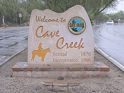
Welcome marker
|
||
|
||
| Motto(s):
Where the Wild West Lives
|
||

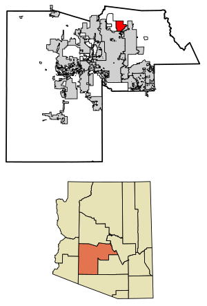
Location in Maricopa County, Arizona
|
||
| Country | United States | |
| State | Arizona | |
| County | Maricopa | |
| Area | ||
| • Total | 37.72 sq mi (97.68 km2) | |
| • Land | 37.71 sq mi (97.66 km2) | |
| • Water | 0.01 sq mi (0.02 km2) | |
| Elevation | 2,553 ft (778 m) | |
| Population
(2020)
|
||
| • Total | 4,892 | |
| • Density | 129.73/sq mi (50.09/km2) | |
| Time zone | UTC−7 (MST (no DST)) | |
| ZIP Codes |
85327, 85331
|
|
| Area code(s) | 480 | |
| FIPS code | 04-11300 | |
| GNIS feature ID | 2413182 | |
Cave Creek is a small town in Maricopa County, Arizona, United States. It is part of the larger Phoenix metropolitan area. In 2020, about 4,892 people lived in Cave Creek. The town's motto is "Where the Wild West Lives," which gives you a hint about its history!
Contents
History of Cave Creek
Cave Creek was first settled in 1870 by soldiers from Fort McDowell. These soldiers were on horseback, exploring the area. Just three years later, in 1873, people looking for gold found some in the town. This discovery helped the town grow.
The town gets its name from a cave located right next to the creek where it was founded. Cave Creek officially became a town in 1986.
Exploring Cave Creek's Geography
Cave Creek is located in the Sonoran Desert, a unique desert environment. It sits in the northern part of Maricopa County, right next to Scottsdale. To the north, you can see mountains that connect to the New River Mountains and the Black Hills.
The town is about 33 miles (53 km) north of downtown Phoenix. However, the city limits of Phoenix reach all the way to Cave Creek's southern border. To the east, Cave Creek borders the town of Carefree. To the west, it's next to an area called New River, and to the north is the huge Tonto National Forest.
Two important mountains are found near Cave Creek. Elephant Mountain, which is 3,926 feet (1,197 meters) tall, is in the northern part of town. Black Mountain, standing at 3,398 feet (1,036 meters), is a local landmark in the southern part of town, right on the border with Carefree.
The town covers about 37.7 square miles (97.6 square kilometers). Most of this area is land, with only a tiny bit of water. The actual Cave Creek flows through the western side of the town, heading south towards Phoenix. It eventually disappears into the Salt River valley.
In 2000, the state of Arizona, Maricopa County, and the town of Cave Creek worked together to buy Spur Cross Ranch. This large area of 2,154 acres (8.72 square kilometers) is just north of Phoenix. It's special because it has unusual cacti, cool rock formations, and hundreds of ancient artifacts from the Hohokam Indian tribe. Now, it's a beautiful Maricopa County park that everyone can visit.
Cave Creek's Climate
Cave Creek has a semi-arid climate. This means it gets more rain than a true desert, but it's still quite dry. Because Cave Creek is at a higher elevation than many other parts of Phoenix, it tends to be a bit cooler.
The hottest time of year is from late May to mid-September. During these months, the average daily high temperature is usually above 93°F (34°C). July is the hottest month, with average highs around 102°F (39°C) and lows around 74°F (23°C).
The cooler season runs from late November to early March. During this time, the average daily high temperature is below 69°F (21°C). January is the coldest month, with average lows around 37°F (3°C) and highs around 65°F (18°C).
From July to September, Cave Creek experiences the North American monsoon season. This brings rain and thunderstorms to the area. August is usually the wettest month, with rain on about 6 days and an average of 1.77 inches (45 mm) of rain.
| Climate data for Cave Creek, Arizona, 1907–1961 | |||||||||||||
|---|---|---|---|---|---|---|---|---|---|---|---|---|---|
| Month | Jan | Feb | Mar | Apr | May | Jun | Jul | Aug | Sep | Oct | Nov | Dec | Year |
| Mean daily maximum °F (°C) | 65.3 (18.5) |
66.6 (19.2) |
72.4 (22.4) |
80.6 (27.0) |
89.2 (31.8) |
99.6 (37.6) |
101.9 (38.8) |
100.3 (37.9) |
96.9 (36.1) |
86.7 (30.4) |
73.6 (23.1) |
65.9 (18.8) |
83.3 (28.5) |
| Mean daily minimum °F (°C) | 37.4 (3.0) |
38.4 (3.6) |
43.0 (6.1) |
48.7 (9.3) |
55.4 (13.0) |
65.9 (18.8) |
73.7 (23.2) |
72.7 (22.6) |
65.9 (18.8) |
54.9 (12.7) |
43.6 (6.4) |
37.5 (3.1) |
53.1 (11.7) |
| Average precipitation inches (mm) | 1.31 (33) |
0.86 (22) |
1.05 (27) |
0.58 (15) |
0.18 (4.6) |
0.16 (4.1) |
1.55 (39) |
1.77 (45) |
0.89 (23) |
0.75 (19) |
0.81 (21) |
1.29 (33) |
11.18 (284) |
| Average snowfall inches (cm) | 0.0 (0.0) |
0.1 (0.25) |
0.0 (0.0) |
0.0 (0.0) |
0.0 (0.0) |
0.0 (0.0) |
0.0 (0.0) |
0.0 (0.0) |
0.0 (0.0) |
0.0 (0.0) |
0.1 (0.25) |
0.2 (0.51) |
0.4 (1.0) |
| Average precipitation days (≥ 0.01 in) | 4 | 3 | 3 | 2 | 1 | 1 | 5 | 6 | 2 | 2 | 3 | 3 | 37 |
| Source: Western Regional Climate Center | |||||||||||||
Population and People of Cave Creek
| Historical population | |||
|---|---|---|---|
| Census | Pop. | %± | |
| 1980 | 1,712 | — | |
| 1990 | 2,925 | 70.9% | |
| 2000 | 3,728 | 27.5% | |
| 2010 | 5,015 | 34.5% | |
| 2020 | 4,892 | −2.5% | |
| U.S. Decennial Census | |||
In 2000, there were 3,728 people living in Cave Creek. The town had 1,571 households, which are groups of people living together. The average household had about 2.37 people.
The population included people of all ages. About 20.9% of the residents were under 18 years old. The median age in the town was 45 years old. This means half the people were younger than 45 and half were older.
Arts and Culture in Cave Creek
Cave Creek has some interesting historic places that show its past. The Cave Creek Museum has buildings like the Tubercular Cabin and the First Church of Cave Creek. These buildings are important parts of the town's history.
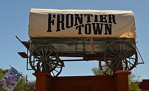
Some old buildings have been turned into new places. For example, the historic Cave Creek Inn and the Cave Creek Service Station are now restaurants. Frontier Town also has some of the original buildings from when Cave Creek was first settled.
Every year, the Sonoran Arts League hosts a special event called "Hidden in the Hills." During this event, about 40 local artists open their home studios to visitors. It's a great way to see their artwork and learn about their creative process.
Education in Cave Creek
Students in Cave Creek attend schools in one of two school districts. The part of town west of a certain line is served by the Deer Valley Unified School District. The rest of the town is served by the Cave Creek Unified School District.
Getting Around Cave Creek
Transportation Options
For air travel, people in Cave Creek can use Phoenix Sky Harbor International Airport or Mesa Gateway Airport for commercial flights. The closest airport, Deer Valley Airport, is very busy with smaller, private planes.
Cave Creek does not have a local bus service like some larger cities. This is because it is not part of the Valley Metro public transportation system.
The main roads in and out of Cave Creek include Cave Creek Road and Carefree Highway. These roads meet at the southern edge of town.
Famous People from Cave Creek
Many interesting people have lived in or have connections to Cave Creek:
- Sonny Barger, who founded the Oakland chapter of the Hells Angels.
- Bob "Boze" Bell, a publisher for True West Magazine.
- Brian Dales, a singer from the band The Summer Set.
- Shane Doan, a professional hockey player who played for the Arizona Coyotes.
- Kiowa Gordon, an actor.
- David Henrie, an actor.
- Taylor Lewan, a professional football player who played for the Tennessee Titans.
- Daisy Mallory, a country music singer-songwriter.
- Earl Simmons, a famous rapper and actor known as DMX.
- Dee Dee Wood, an Emmy Award-winning choreographer.
See also
 In Spanish: Cave Creek para niños


