Cedar Mountain, Virginia facts for kids
Quick facts for kids Cedar Mountain |
|
|---|---|

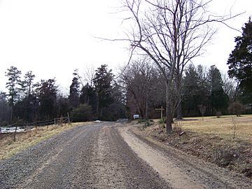
Along Cedar Mountain near Rapidan
|
|
| Highest point | |
| Elevation | 814 ft (248 m) Mountainzone |
| Prominence | 400 ft (120 m) |
| Geography | |
| Location | Culpeper County, Virginia, U.S. |
| Parent range | Piedmont Monadnock |
| Topo map | USGS Culpeper |
| Climbing | |
| Easiest route | Hike |
Cedar Mountain, also known as Slaughter Mountain, is a special kind of mountain called a piedmont monadnock in Culpeper County, Virginia. It's like a lone hill standing out from the flatter land around it. This mountain is about 800 feet (240 m) tall and is located about 7 miles (11 km) south of the town of Culpeper. It played an important role during the American Civil War.
Contents
What is a Monadnock?
A monadnock is a mountain or hill that stands out by itself. It rises above the flatter land around it. Imagine a big rock sticking up in a wide, flat field. That's kind of like a monadnock! Cedar Mountain is a great example of this type of landform. It's part of the Piedmont area in Virginia.
Cedar Mountain's Location
Cedar Mountain is found in Culpeper County, Virginia. It's about 7 miles (11 km) south of the town of Culpeper. The mountain is also near the northern tip of the Southwest Mountains. Its location made it a key spot for soldiers during the Civil War.
A Civil War Landmark
Cedar Mountain was very important during the American Civil War. Soldiers used it as a signal mountain. From its top, they could see far across the land. This helped them send messages and watch for enemy movements. You can still see parts of the old fortifications there today. These are like old walls or trenches built for defense.
The Battle of Cedar Mountain
A big battle happened here on August 9, 1862. It was called the Battle of Cedar Mountain. This battle was part of the Civil War. It was fought between the Union and Confederate armies.
Who Fought There?
The Union forces were led by Major General Nathaniel P. Banks. The Confederate forces were commanded by General Stonewall Jackson. Jackson was a very famous Confederate leader.
What Happened?
The battle started in the late afternoon. Union troops attacked the Confederates. The fighting was very fierce. Both sides fought hard for control of the mountain. The Confederates eventually pushed back the Union army. This was a victory for the Confederates.
Why Was It Important?
The Battle of Cedar Mountain was a key moment in the Civil War. It showed the strength of the Confederate army. It also helped set the stage for the Second Battle of Bull Run. This battle is remembered as a significant event in American history. It reminds us of the brave soldiers who fought there.
 | Delilah Pierce |
 | Gordon Parks |
 | Augusta Savage |
 | Charles Ethan Porter |

