Cedar Vale, Queensland facts for kids
Quick facts for kids Cedar ValeLogan City, Queensland |
|||||||||||||||
|---|---|---|---|---|---|---|---|---|---|---|---|---|---|---|---|

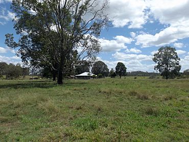
Fields along Cedar Vale Road, 2016
|
|||||||||||||||
| Population | 2,856 (2021 census) | ||||||||||||||
| • Density | 181.9/km2 (471/sq mi) | ||||||||||||||
| Postcode(s) | 4285 | ||||||||||||||
| Area | 15.7 km2 (6.1 sq mi) | ||||||||||||||
| Time zone | AEST (UTC+10:00) | ||||||||||||||
| Location |
|
||||||||||||||
| LGA(s) | Logan City | ||||||||||||||
| State electorate(s) | Scenic Rim | ||||||||||||||
| Federal Division(s) | Wright | ||||||||||||||
|
|||||||||||||||
Cedar Vale is a quiet, rural area in Queensland, Australia. It's part of Logan City, which is a local government area. Imagine a place with lots of open spaces and a friendly community. In 2021, about 2,856 people called Cedar Vale home. It's known for its peaceful, country feel.
Contents
Exploring Cedar Vale's Location
Cedar Vale has some interesting natural features. The Mount Lindesay Highway runs along its north-western side. This is a main road that helps people travel around the region.
A waterway called Scrubby Creek forms the northern and eastern edges of Cedar Vale. Creeks like this are important for local wildlife and the environment. They often provide homes for different plants and animals.
A Look at Cedar Vale's Past
Cedar Vale used to be part of a different local government area. This area was called the Shire of Beaudesert. But in March 2008, things changed! Cedar Vale became part of Logan City. This was part of a bigger plan to make local government more efficient in Queensland.
Who Lives in Cedar Vale?
We know how many people live in Cedar Vale thanks to regular counts called censuses. These counts help us understand how communities are growing or changing.
In 2021, the population of Cedar Vale was 2,856 people. This number helps us see how many residents call this rural locality home.
Schools for Cedar Vale Kids
If you live in Cedar Vale, you won't find a school right in the area. But don't worry, there are schools nearby!
For primary school, kids often go to Jimboomba State School in Jimboomba. Other options include Veresdale Scrub State School or Woodhill State School.
For high school, students usually attend Flagstone State Community College in Flagstone. Another choice is Beaudesert State High School in Beaudesert.
Parks and Fun Places
Cedar Vale has several parks where you can enjoy the outdoors. These parks are great spots for playing, relaxing, or just enjoying nature.
Here are some of the parks in the area:
- Birchwood Street Park (27°52′59″S 153°00′42″E / 27.8831°S 153.0117°E)
- Cedar Vale Road Park (27°52′16″S 153°00′28″E / 27.8712°S 153.0077°E)
- Harrison Road Park (27°53′24″S 153°02′22″E / 27.8901°S 153.0394°E)
- Kamala Court Park (27°52′03″S 153°00′01″E / 27.8676°S 153.0002°E)
- Millstream Road Park (27°52′26″S 153°01′07″E / 27.8738°S 153.0187°E)
- Quail Street Park (27°53′02″S 153°01′21″E / 27.8839°S 153.0226°E)
 | Jessica Watkins |
 | Robert Henry Lawrence Jr. |
 | Mae Jemison |
 | Sian Proctor |
 | Guion Bluford |


