Centerville, South Carolina facts for kids
Quick facts for kids
Centerville
|
|
|---|---|

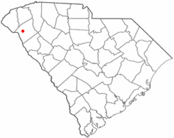
Location of Centerville, South Carolina
|
|
| Country | United States |
| State | South Carolina |
| County | Anderson |
| Area | |
| • Total | 5.94 sq mi (15.37 km2) |
| • Land | 5.91 sq mi (15.29 km2) |
| • Water | 0.03 sq mi (0.08 km2) |
| Elevation | 833 ft (254 m) |
| Population
(2020)
|
|
| • Total | 7,185 |
| • Density | 1,216.77/sq mi (469.82/km2) |
| Time zone | UTC-5 (Eastern (EST)) |
| • Summer (DST) | UTC-4 (EDT) |
| ZIP code |
29625
|
| Area code(s) | 864 |
| FIPS code | 45-12965 |
| GNIS feature ID | 1236603 |
Centerville is a special kind of community in Anderson County, South Carolina. It's called a census-designated place (CDP). This means it's an area that the government counts as a community for statistics, but it doesn't have its own local government like a city or town. In 2020, about 7,185 people lived in Centerville.
Contents
Where is Centerville Located?
Centerville is a community found in the middle of Anderson County, South Carolina. It's located west of Anderson, which is the main city and county seat for the area.
Getting Around Centerville
A major highway called Interstate 85 is about 4 miles (6.4 km) north of Centerville. This highway is important for travel in Upstate South Carolina. You can also find Lake Hartwell just 2 miles (3.2 km) to the west, which is a popular spot for outdoor activities.
How Big is Centerville?
Centerville covers a total area of about 5.9 square miles (15.4 square kilometers). Most of this area, about 5.9 square miles (15.3 square kilometers), is land. A small part, about 0.03 square miles (0.08 square kilometers), is water.
Who Lives in Centerville?
The number of people living in Centerville has grown over the years. Here's a quick look at the population counts from different years:
| Historical population | |||
|---|---|---|---|
| Census | Pop. | %± | |
| 2000 | 5,181 | — | |
| 2010 | 6,586 | 27.1% | |
| 2020 | 7,185 | 9.1% | |
| U.S. Decennial Census | |||
Centerville's Population in 2020
In 2020, the 2020 United States census counted 7,185 people living in Centerville. These people lived in 2,990 households, and 1,870 of these were families. The community is made up of people from many different backgrounds.
| Race | Num. | Perc. |
|---|---|---|
| White (non-Hispanic) | 5,326 | 74.13% |
| Black or African American (non-Hispanic) | 1,250 | 17.4% |
| Native American | 15 | 0.21% |
| Asian | 79 | 1.1% |
| Pacific Islander | 2 | 0.03% |
| Other/Mixed | 288 | 4.01% |
| Hispanic or Latino | 225 | 3.13% |
See also
 In Spanish: Centerville (Carolina del Sur) para niños
 | Janet Taylor Pickett |
 | Synthia Saint James |
 | Howardena Pindell |
 | Faith Ringgold |

