Centralhatchee, Georgia facts for kids
Quick facts for kids
Centralhatchee, Georgia
|
|
|---|---|

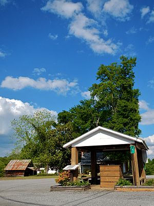
Centralhatchee in 2012
|
|

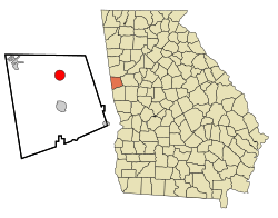
Location in Heard County and the state of Georgia
|
|
| Country | United States |
| State | Georgia |
| County | Heard |
| Area | |
| • Total | 3.28 sq mi (8.49 km2) |
| • Land | 3.28 sq mi (8.49 km2) |
| • Water | 0.00 sq mi (0.00 km2) |
| Elevation | 846 ft (258 m) |
| Population
(2020)
|
|
| • Total | 348 |
| • Density | 106.19/sq mi (41.01/km2) |
| Time zone | UTC-5 (Eastern (EST)) |
| • Summer (DST) | UTC-4 (EDT) |
| ZIP Code |
30217
|
| Area code(s) | 706 |
| FIPS code | 13-15026 |
| GNIS feature ID | 0355098 |
Centralhatchee is a small town located in Heard County, Georgia, in the United States. In 2020, about 348 people lived there. It's a quiet place with a unique history.
Contents
History of Centralhatchee
How Centralhatchee Got Its Name
The area where Centralhatchee is now was once called "Black Ankle". This was a special area known as a militia district. A militia district was a local area for defense and administration. Another nearby community, Glenloch, was known as "Blue Shin".
According to old Native American stories, the way these two communities were shaped on the land looked like the ankle and shin parts of a leg. This is how they got their interesting names.
Becoming a Town
Centralhatchee became part of Heard County in 1830. This happened when Heard County was created from parts of other counties like Carroll, Troup, and Coweta.
The town officially became "Centralhatchee" in 1903. Its name comes from a nearby stream called Centralhatchee Creek.
Geography of Centralhatchee
Where Centralhatchee Is Located
Centralhatchee is in the northern part of Heard County. It is located at coordinates 33°22′7″N 85°6′15″W. A stream called Centralhatchee Creek flows just west of the town. This creek flows south and eventually joins the Chattahoochee River.
Roads and Size
U.S. Route 27 is a four-lane highway that runs through the western side of Centralhatchee. If you drive south on this highway for about 7 miles (11 km), you will reach Franklin. Franklin is the main town and county seat of Heard County. If you drive north for about 16 miles (26 km), you will get to Carrollton.
The town of Centralhatchee covers a total area of about 3.28 square miles (8.5 square kilometers). All of this area is land.
Population of Centralhatchee
| Historical population | |||
|---|---|---|---|
| Census | Pop. | %± | |
| 1910 | 119 | — | |
| 1920 | 151 | 26.9% | |
| 1930 | 176 | 16.6% | |
| 1940 | 201 | 14.2% | |
| 1950 | 239 | 18.9% | |
| 1960 | 174 | −27.2% | |
| 1970 | 186 | 6.9% | |
| 1980 | 240 | 29.0% | |
| 1990 | 301 | 25.4% | |
| 2000 | 383 | 27.2% | |
| 2010 | 408 | 6.5% | |
| 2020 | 348 | −14.7% | |
| U.S. Decennial Census | |||
The population of Centralhatchee has changed over the years. In the year 2000, there were 383 people living in the town. By 2020, the population was 348 people.
Famous People from Centralhatchee
- Roy Lee Johnson – A talented songwriter, singer, and guitarist known for his R&B and soul music.
- Hugh McGraw – A well-known leader and composer of Sacred Harp music.
See also
 In Spanish: Centralhatchee (Georgia) para niños
 | Madam C. J. Walker |
 | Janet Emerson Bashen |
 | Annie Turnbo Malone |
 | Maggie L. Walker |

