Chagres River facts for kids
Quick facts for kids Chagres River |
|
|---|---|

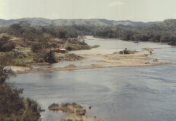
The Chagres River as seen from the highway between Panama City and Colon
|
|
|
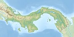
Location of mouth
|
|
| Country | Panama |
| Physical characteristics | |
| Main source | Chagres National Park, Panamá Province, Panama 9°24′N 79°17′W / 9.400°N 79.283°W |
| River mouth | Chagres, Colón Province, Panama 9°19′N 80°0′W / 9.317°N 80.000°W |
| Length | 120 mi (190 km), east to west |
| Basin features | |
| Basin size | 1,259.5 sq mi (3,262 km2) |
The Chagres River is a very important river in central Panama. It is the biggest river that feeds the Panama Canal. The river has two big dams. These dams create two large lakes, Gatun Lake and Lake Alajuela. These lakes are a key part of the canal's water system.
Normally, the Chagres River flows northwest to the Caribbean Sea. But its waters also go through the canal's locks into the Gulf of Panama in the south. This means the Chagres River is special because its water flows into two different oceans!
Contents
The Upper Chagres River and Lake Alajuela
The upper part of the Chagres River and its surrounding land are inside the Chagres National Park. This park was created in 1985. Its main goal is to protect the natural environment and make sure water keeps flowing into the Panama Canal.
The land around the upper Chagres River is very hilly. About 90 percent of the area has steep mountain slopes. Most of the park, about 98 percent, is made up of old tropical forest.
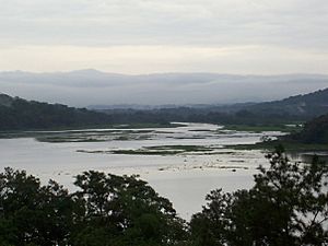
The upper Chagres River and its seven smaller rivers flow into Lake Alajuela. This lake used to be called Madden Lake. It was formed by the Madden Dam. These rivers provide 45 percent of all the water needed for the canal. This makes Lake Alajuela a very important part of the canal's water system.
Lake Alajuela can hold a lot of water. It can store one-third of the water the canal needs each year to operate its locks. The lake is not part of the shipping route, so its water level can change more freely than Gatun Lake. Water from Lake Alajuela is also used to create electricity and to provide fresh drinking water for Panama City.
Gatun Dam and Gatun Lake
The Gatun Dam is about 3.2 kilometres (2.0 mi) from where the river meets the sea. This dam created Gatun Lake and also produces hydroelectric power. Gatun Lake was formed in 1913 when the Chagres River was dammed. It is a vital part of the Panama Canal. The canal helps ships travel between the Atlantic Ocean and the Pacific Ocean.
Gatun Lake is very important for the canal's water supply. It provides millions of gallons of water at the high level needed for the canal's locks to work correctly. The lake is also part of the canal's shipping route. It provides drinking water for Panama City and Colon too.
When it was first created, Gatun Lake was the largest man-made lake in the world. The thick rainforest around Gatun Lake has helped protect the Panama Canal for many years. Today, these areas are still mostly untouched by people. They are some of the best places to see native Central American animals and plants in their natural home.
Barro Colorado Island is the largest island on Gatun Lake. It was set aside for scientific study when the lake was made. Today, the Smithsonian Institution manages it. This island is famous worldwide for its scientific discoveries about tropical animals and plants. Gatun Lake covers about 470 square kilometres (180 sq mi). It is a huge tropical area that is part of the Atlantic Forest Corridor. Visiting Gatun Lake to see its nature has become a valuable business for people in Panama.
Fishing is a popular activity on Gatun Lake. A type of fish called Cichla pleiozona, also known as peacock bass, was accidentally introduced to Gatun Lake in 1958. Locals call them Sargento. These fish are not originally from Panama. They come from the Amazon and Orinoco River basins in South America. There, they are called Tucanare or Pavon and are considered a top game fish. Since 1958, the Cichla pleiozona has grown in number and become the main game fish in Gatun Lake. They are known for fighting hard when caught. They also prefer to feed during the day.
History of the Chagres River
The Chagres River has a long history. In 1506, Spanish explorers Diego Cueto and Pedro de Umbria visited the area. Later, in 1527, Hernando de la Serna explored the river. He founded the town of Chagres at the river's mouth and built a fort called San Lorenzo there.
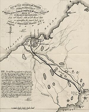
Goods were carried by foot from Panama City to the town of Cruces on the Chagres River. From Cruces, they were moved by sailboats down the river to its mouth. This route, called Camino de Cruces, was very popular until the 1700s.
The famous pirate Henry Morgan used the Chagres River to reach and attack Panama City in 1670–71.
For a long time, not much attention was paid to the river. But in the late 1800s, it became important again. This was when people started planning to build the Panama Canal. The Chagres River is the main source of water for the Panama Canal.
The upper part of the river's basin is covered by thick tropical forests. To protect this natural area, Panama created Chagres National Park in 1985.
See also
 In Spanish: Río Chagres para niños
 | Emma Amos |
 | Edward Mitchell Bannister |
 | Larry D. Alexander |
 | Ernie Barnes |


