Champdor-Corcelles facts for kids
Quick facts for kids
Champdor-Corcelles
|
||
|---|---|---|
|
Commune
|
||

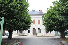
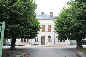
Town hall
|
||
|
||
| Country | France | |
| Region | Auvergne-Rhône-Alpes | |
| Department | Ain | |
| Arrondissement | Belley | |
| Canton | Plateau d'Hauteville | |
| Intercommunality | Haut-Bugey Agglomération | |
| Area
1
|
31.53 km2 (12.17 sq mi) | |
| Population
(2021)
|
645 | |
| • Density | 20.457/km2 (52.98/sq mi) | |
| Time zone | UTC+01:00 (CET) | |
| • Summer (DST) | UTC+02:00 (CEST) | |
| INSEE/Postal code |
01080 /01110
|
|
| 1 French Land Register data, which excludes lakes, ponds, glaciers > 1 km2 (0.386 sq mi or 247 acres) and river estuaries. | ||
Champdor-Corcelles is a small town, also called a commune, in eastern France. It is located in the Ain department. Think of a department like a county or a region.
This commune was created on January 1, 2016. It was formed by joining two older towns: Champdor and Corcelles.
Contents
About Champdor-Corcelles
Champdor-Corcelles is a quiet place in the Ain department. It is part of the Belley arrondissement. An arrondissement is like a district within a department.
The town is also part of the Plateau d'Hauteville canton. A canton is a smaller area used for elections.
How Many People Live Here?
In 2021, about 645 people lived in Champdor-Corcelles. This makes it a small community.
Who is in Charge?
The mayor of Champdor-Corcelles is Stéphane Martinand. He was elected in 2020 and will serve until 2026. The mayor helps run the town and make decisions for its people.
The town also works with other nearby towns. This group is called Haut-Bugey Agglomération. They work together on things like public services.
Where is it Located?
Champdor-Corcelles covers an area of about 31.53 square kilometers. You can find it using its coordinates: 46.017 degrees North and 5.597 degrees East.
See also
 In Spanish: Champdor-Corcelles para niños
 | Sharif Bey |
 | Hale Woodruff |
 | Richmond Barthé |
 | Purvis Young |


