Charlestown (CDP), Rhode Island facts for kids
Quick facts for kids
Charlestown, Rhode Island
|
|
|---|---|
| Country | United States |
| State | Rhode Island |
| County | Washington |
| Towns | Charlestown South Kingstown |
| Area | |
| • Total | 2.84 sq mi (7.35 km2) |
| • Land | 2.26 sq mi (5.86 km2) |
| • Water | 0.57 sq mi (1.49 km2) |
| Elevation | 22 ft (7 m) |
| Population
(2020)
|
|
| • Total | 1,714 |
| • Density | 757.40/sq mi (292.42/km2) |
| Time zone | UTC-5 (Eastern (EST)) |
| • Summer (DST) | UTC-4 (EDT) |
| ZIP Codes | |
| Area code(s) | 401 |
| FIPS code | 44-14320 |
| GNIS feature ID | 2631329 |
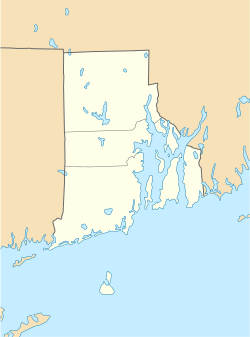
Charlestown is a special kind of community in Rhode Island, United States. It's called a census-designated place (CDP). This means it's an area that the government counts for population, but it's not a separate city or town. Charlestown is located in Washington County.
This area includes the main village of Charlestown. It also stretches east into the nearby town of South Kingstown. The government first counted Charlestown as a CDP before the 2020 census.
Contents
Where is Charlestown Located?
Charlestown is in the southern part of Washington County. It sits on the north side of Ninigret Pond. This pond is a tidal lagoon, which means its water levels change with the ocean tides. Ninigret Pond is connected to Block Island Sound.
The community is partly in the southeast of the town of Charlestown. It is also partly in the southwest of the town of South Kingstown. The main village of Charlestown is in the northwest part of the CDP. It is right at the northern end of Ninigret Pond.
Charlestown Beach Area
The area known as Charlestown Beach is in the southern part of the CDP. It is separated from the actual Charlestown Beach by a small tidal inlet. This inlet connects to the Atlantic Ocean. The CDP continues eastward into South Kingstown. There, it is on the north side of Green Hill Pond.
Getting Around Charlestown
U.S. Route 1 runs along the northern edge of the Charlestown CDP. This major highway helps people travel to other places. If you go northeast on Route 1, you will reach Narragansett in about 10 miles. If you head west, you will get to Westerly in about 11 miles.
How Many People Live in Charlestown?
The number of people living in Charlestown is counted by the government. This count happens every ten years.
- In 2020, the population of Charlestown was 1,714 people.
This information comes from the U.S. Decennial Census.
 | Anna J. Cooper |
 | Mary McLeod Bethune |
 | Lillie Mae Bradford |


