Cheswold, Delaware facts for kids
Quick facts for kids
Cheswold, Delaware
|
|
|---|---|

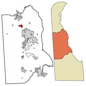
Location of Cheswold in Kent County, Delaware
|
|
| Country | |
| State | |
| County | |
| Government | |
| • Type | Council-manager |
| Area | |
| • Total | 1.84 sq mi (4.76 km2) |
| • Land | 1.84 sq mi (4.76 km2) |
| • Water | 0.00 sq mi (0.00 km2) |
| Elevation | 36 ft (11 m) |
| Population
(2020)
|
|
| • Total | 1,923 |
| • Density | 1,046.25/sq mi (404.00/km2) |
| Time zone | UTC−5 (Eastern (EST)) |
| • Summer (DST) | UTC−4 (EDT) |
| ZIP Code |
19936
|
| Area code(s) | 302 |
| FIPS code | 10-14660 |
| GNIS feature ID | 213795 |
Cheswold is a town in Kent County in the U.S. state of Delaware. It is part of the Dover, Delaware area. In 2020, the town had a population of 1,923 people.
Contents
History of Cheswold
The town of Cheswold began to grow after a railroad was built in 1856. Before 1888, the town was called Moorton. This name came from James S. Moore, who owned land in the area.
Geography of Cheswold
Cheswold is located at 39°13′09″N 75°35′09″W / 39.21917°N 75.58583°W. The town covers a total area of about 1.84 square miles (4.76 square kilometers). All of this area is land.
People of Cheswold
| Historical population | |||
|---|---|---|---|
| Census | Pop. | %± | |
| 1890 | 129 | — | |
| 1900 | 201 | 55.8% | |
| 1910 | 223 | 10.9% | |
| 1920 | 287 | 28.7% | |
| 1930 | 211 | −26.5% | |
| 1940 | 232 | 10.0% | |
| 1950 | 292 | 25.9% | |
| 1960 | 281 | −3.8% | |
| 1970 | 286 | 1.8% | |
| 1980 | 269 | −5.9% | |
| 1990 | 321 | 19.3% | |
| 2000 | 313 | −2.5% | |
| 2010 | 1,380 | 340.9% | |
| 2020 | 1,923 | 39.3% | |
| U.S. Decennial Census | |||
In 2000, there were 313 people living in Cheswold. These people lived in 116 households, with 80 of them being families. The population density was about 730 people per square mile.
Many households had children under 18 living with them. About 42% of households were married couples. The average household had 2.70 people.
The population of Cheswold is quite diverse. About 30% of the people were under 18 years old. The median age in the town was 30 years.
Town Services and Transport
Transportation in Cheswold
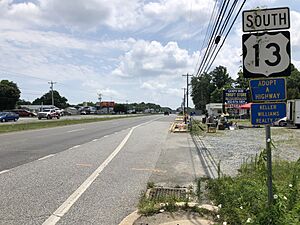
U.S. Route 13 is a main road that goes through Cheswold. It runs north to cities like Smyrna and Wilmington. It also goes south to Dover.
Delaware Route 42 is another important road. It goes east and west through the town. You can take it west to Kenton or east to Leipsic.
For public transport, DART First State offers bus service. Route 120 connects Cheswold to Dover and Smyrna. A railroad line, the Delmarva Subdivision, also passes through the town. Delaware Airpark, a small airport, is located nearby.
Utilities in Cheswold
Cheswold gets its water and sewer services from the Middlesex Water Company. Electricity is provided by Delmarva Power. Natural gas comes from Chesapeake Utilities.
Several companies handle trash and recycling in the town. These include Republic Services and Waste Management. For internet and cable, residents can choose from providers like Xfinity and Verizon.
Education in Cheswold
Cheswold is part of the Capital School District. Students in the town attend schools within this district. The main high school for the area is Dover High School.
Notable People from Cheswold
- J. Caleb Boggs was a famous politician from Delaware. He served as a U.S. Representative and later as the 62nd Governor of Delaware. He also became a U.S. Senator.
See also
 In Spanish: Cheswold para niños
 | Mary Eliza Mahoney |
 | Susie King Taylor |
 | Ida Gray |
 | Eliza Ann Grier |


