Chillicothe, Iowa facts for kids
Quick facts for kids
Chillicothe, Iowa
|
|
|---|---|

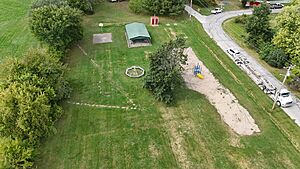
Chillicothe Park
|
|

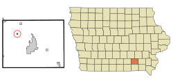
Location of Chillicothe, Iowa
|
|
| Country | |
| State | |
| County | Wapello |
| Incorporated | December 22, 1881 |
| Area | |
| • Total | 0.25 sq mi (0.65 km2) |
| • Land | 0.23 sq mi (0.59 km2) |
| • Water | 0.02 sq mi (0.06 km2) |
| Elevation | 686 ft (209 m) |
| Population
(2020)
|
|
| • Total | 76 |
| • Density | 336.28/sq mi (129.79/km2) |
| Time zone | UTC-6 (Central (CST)) |
| • Summer (DST) | UTC-5 (CDT) |
| ZIP code |
52548
|
| Area code(s) | 641 |
| FIPS code | 19-13215 |
| GNIS feature ID | 2393516 |
Chillicothe is a small city located in Wapello County, Iowa, in the United States. In 2020, about 76 people lived there. It's a quiet place with an interesting history.
Contents
History of Chillicothe
Chillicothe was first planned out in 1849. It officially became a city in 1881.
Meaning of the Name
The name "Chillicothe" comes from old words of the Shawnee Native American people. It means "Principal Place." This name was also used for one of their important clans.
The main chief of the Shawnee people could only come from the Chillicothe clan. When a village was called Chillicothe, it meant that the main chief lived there. It was like the capital city for the Shawnees. When a chief passed away, the capital would move to the home village of the next main chief. That new village would then be called Chillicothe.
Notable Resident
Chillicothe is the burial place of Curtis King. He was the oldest person to serve in the American Civil War.
Geography of the City
Chillicothe is a small city in terms of size. The United States Census Bureau says the city covers about 0.24 square miles (0.62 square kilometers). Most of this area is land, and a very small part is water.
Population and People
| Historical populations | ||
|---|---|---|
| Year | Pop. | ±% |
| 1870 | 211 | — |
| 1880 | 234 | +10.9% |
| 1890 | 214 | −8.5% |
| 1900 | 216 | +0.9% |
| 1910 | 181 | −16.2% |
| 1920 | 146 | −19.3% |
| 1930 | 156 | +6.8% |
| 1940 | 173 | +10.9% |
| 1950 | 196 | +13.3% |
| 1960 | 148 | −24.5% |
| 1970 | 126 | −14.9% |
| 1980 | 131 | +4.0% |
| 1990 | 119 | −9.2% |
| 2000 | 90 | −24.4% |
| 2010 | 97 | +7.8% |
| 2020 | 76 | −21.6% |
| Source: and Iowa Data Center Source: |
||
2020 Census Information
In 2020, the census counted 76 people living in Chillicothe. There were 30 households and 22 families. The city had about 336 people per square mile.
Most of the people living in Chillicothe were White. A small number of people were from other racial backgrounds. About 5% of the population identified as Hispanic or Latino.
The average age in the city was 47.5 years old. About 17% of residents were under 20. Another 17% were 65 years or older. The rest were between 20 and 64 years old. Slightly more males lived in the city than females.
2010 Census Information
The census in 2010 recorded 97 people living in Chillicothe. There were 35 households and 21 families. The population density was about 422 people per square mile.
All residents identified as White. About 1% of the population was Hispanic or Latino.
About 28% of the residents were under 18 years old. The median age was 35.5 years. The number of males and females was almost equal.
Education in Chillicothe
The very first school in Chillicothe was a one-room schoolhouse. It was called Chillicothe #1. This old school building is no longer standing today.
Today, Chillicothe is part of a larger school system. It is in the Eddyville–Blakesburg–Fremont Community School District. This district was formed in 2012 when two smaller districts joined together. Before that, Chillicothe was part of the Eddyville–Blakesburg district.
City Infrastructure
On the west side of Chillicothe, there is a large power plant. This plant burns coal to create electricity. It provides power to a big part of southeastern Iowa.
The town also has a bridge that crosses the Des Moines River. This bridge helps people travel in and out of the city.
See also
 In Spanish: Chillicothe (Iowa) para niños

