Choctaw Corner facts for kids
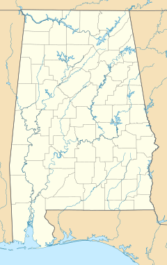
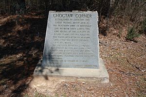
The Choctaw Corner is a special place in Alabama, United States. It's near where Clarke and Marengo counties meet today. This spot was once an important boundary line for two Native American groups: the Choctaw and the Creek peoples. They agreed on this line during the time of the Mississippi Territory. This old boundary, sometimes called the "Old Indian Treaty Boundary," starts at the Alabama River in southern Clarke County. It goes north through the county, following the high ground between the Tombigbee and Alabama rivers. When it reaches Choctaw Corner, the line turns west. It then follows the modern county line between Clarke and Marengo counties all the way to the Tombigbee River.
History of the Choctaw Corner
The story of the Choctaw Corner began about ten years before the Creek War. At that time, white settlers were moving onto lands that the Creek people felt belonged to them. The Creek had already faced similar issues with settlers moving into their eastern lands in Georgia.
The Choctaw people said that the lands in modern Clarke County, from the Tombigbee River eastward to the high ground, were theirs. The Creek people had traditionally claimed the lands from the Alabama River westward to the high ground. However, by 1802, the Alibamu, who were part of the Creek Confederacy and lived closest to the new settlers, claimed their territory reached all the way to the Tombigbee River.
After a lot of discussion, strong pressure, and a payment of $50,000 plus goods worth $3,000 each year, the Choctaw signed the Treaty of Mount Dexter with the United States. This happened on November 16, 1805. In this treaty, the Choctaw gave up a huge area of their land, about 4.1 million acres (16,765 square kilometers). This included the land east of the Tombigbee River that had been in dispute.
Around 1808, the Choctaw and Creek peoples decided to settle their argument over the land between the two rivers. They chose to play a traditional ball game. The Choctaw won the game, but the Creek were not happy with the result. So, the two groups decided to let their women play a second game. The Choctaw women also won, and this finally settled the land dispute between them.
President Thomas Jefferson was possibly disappointed that the treaty did not include the rich lands on the east bank of the Mississippi River. Because of this, he waited over two years to get the treaty approved by the Senate. The boundary line was finally measured and marked in 1809. Both Creek and Choctaw people helped with this important survey.
Many years later, in the 1830s, Native American peoples were moved from their traditional lands. After this, European-American settlers started a new town. They named it Choctaw Corner, and it was built a few miles southeast of the original boundary marker.
 | Leon Lynch |
 | Milton P. Webster |
 | Ferdinand Smith |


