Chouteau Island facts for kids
Chouteau Island (pronounced shoh-TOH) is a special island located about 8 kilometers (5 miles) north of the Gateway Arch in St. Louis, Missouri. It's also about 1 kilometer (0.6 miles) south of where the Missouri River and Mississippi River meet.
Chouteau Island is part of a group of three islands. The other two are Gabaret Island and Mosenthein Island. Together, these three islands cover a huge area of about 5,500 acres (22 square kilometers). They are all found in Madison County, Illinois. Sometimes, the whole group of islands is simply called "Chouteau Island."
This island is unique because it's man-made. It was created between 1946 and 1953. This happened during the building of the Chain of Rocks Canal. Most of Chouteau Island is in Chouteau Township. A smaller part of it is in Venice Township. Both townships are in Madison County, Illinois.
Contents
About Chouteau Island
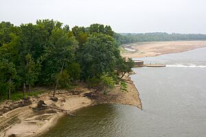
Chouteau Island itself is about 3,200 acres (13 square kilometers) in size. The mighty Mississippi River forms its western border. To the east, you'll find the Chain of Rocks Canal.
The 10 kilometers (6 miles) of the Mississippi River next to the island are very special. This is the only natural part of the Mississippi River without large barge traffic. This quiet stretch runs between Saint Paul, Minnesota and New Orleans, Louisiana.
How to Visit Chouteau Island
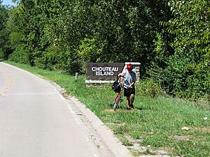
You can reach Chouteau Island by car from Illinois. You'll cross a one-lane bridge called the Canal Bridge. This bridge goes over the Chain of Rocks Canal.
If you are coming from Missouri, you can get to the island by walking or biking. You'll use the U.S. Route 66's Old Chain of Rocks Bridge. It's a great way to see the area.
Fun Things to Do on the Island
Chouteau Island is an important part of the Confluence Greenway. This is a large area for outdoor fun and recreation. Many popular events happen here.
One exciting event is Eagle Days, held every January. People come to watch beautiful bald eagles. There are also many bicycle rides for all ages. Several trails for walking and biking have been built on the island.
History of the Islands
The famous explorers Lewis and Clark camped on Gabaret Island. This was on December 11, 1803. They camped there before setting up their main camp, Camp Dubois, near Wood River, Illinois.
The Mississippi River Lock #27, also known as the Chain of Rocks Lock, is at the southern end of Chouteau Island. Locks help boats move between different water levels.
Protecting the Island
After the Great Flood of 1993, the government bought all the homes on the island complex. Now, over 70 percent of Chouteau Island is owned by the public.
It is managed by the United States Army Corps of Engineers, the Illinois Department of Natural Resources, and the city of Madison, Illinois. They are working together to make Chouteau Island a great place for recreation.
Their plans include restoring floodplains and grasslands. They also want to add more trails, picnic areas, and camping spots. A visitors center is planned near the entrance to the Old Chain of Rocks Bridge.
See also
 In Spanish: Isla Chouteau para niños
 | Isaac Myers |
 | D. Hamilton Jackson |
 | A. Philip Randolph |


