Christiana, Pennsylvania facts for kids
Quick facts for kids
Christiana, Pennsylvania
|
||
|---|---|---|
|
Borough
|
||

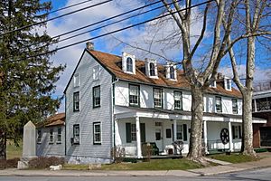
Zercher Hotel
|
||
|
||

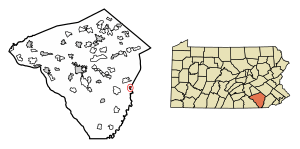
Location in Lancaster County, Pennsylvania
|
||
| Country | United States | |
| State | Pennsylvania | |
| County | Lancaster | |
| Incorporated | 1894 | |
| Area | ||
| • Total | 0.53 sq mi (1.37 km2) | |
| • Land | 0.53 sq mi (1.37 km2) | |
| • Water | 0.00 sq mi (0.01 km2) | |
| Elevation | 489 ft (149 m) | |
| Population
(2020)
|
||
| • Total | 1,112 | |
| • Density | 2,110.06/sq mi (814.29/km2) | |
| Time zone | UTC-5 (EST) | |
| • Summer (DST) | UTC-4 (EDT) | |
| ZIP Code |
17509
|
|
| Area code(s) | 610 | |
| FIPS code | 42-13512 | |
Christiana is a small town, also known as a borough, located in Lancaster County, Pennsylvania, United States. In 2020, about 1,100 people lived there.
Christiana is famous for a historical event that happened in 1851. This event, sometimes called the Christiana Riot or the Battle of Christiana, was an important moment in the fight against slavery in the United States.
Contents
History of Christiana
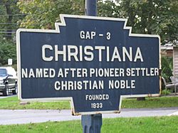
Christiana was once known by a different name: Nobleville. The town's current name, Christiana, comes from Christiana Noble. She was the wife of one of the first people to settle in the area.
On September 11, 1851, Christiana became the site of a very important event. This event, known as the Battle of Christiana, involved local residents. They stood up to defend a person who had escaped slavery. During the conflict, a slaveowner was killed.
People from the Southern states demanded that those involved be punished. They were even accused of treason, which means trying to overthrow the government. However, the first person put on trial was found not guilty. After this, the government decided to drop the other cases. This trial was the first time a court case about the Fugitive Slave Act of 1850 gained national attention. The Fugitive Slave Act was a law that said escaped enslaved people had to be returned to their owners, even if they reached free states.
Geography of Christiana
Christiana is located in the eastern part of Lancaster County. You can find it at these coordinates: 39°57′19″N 75°59′46″W / 39.95528°N 75.99611°W.
The town is surrounded by other areas. To the north, west, and south, it borders Sadsbury Township. To the east, it borders West Sadsbury Township, which is in Chester County.
Pennsylvania Route 372 is a main road that goes through the middle of Christiana. If you travel east on this road, you will reach Parkesburg in about 5 miles. Going west for about 11 miles will take you to Quarryville. To get to Lancaster, which is about 19 miles northwest, you can take Pennsylvania Route 41 and then U.S. Route 30.
The U.S. Census Bureau states that Christiana covers a total area of about 1.37 square kilometers (0.53 square miles). Almost all of this area is land.
The town is in a valley near Pine Creek. This creek forms the border between Lancaster County and Chester County. Pine Creek then flows south into Octoraro Creek, which eventually joins the Susquehanna River.
Population Information
| Historical population | |||
|---|---|---|---|
| Census | Pop. | %± | |
| 1880 | 469 | — | |
| 1900 | 828 | — | |
| 1910 | 934 | 12.8% | |
| 1920 | 985 | 5.5% | |
| 1930 | 959 | −2.6% | |
| 1940 | 1,062 | 10.7% | |
| 1950 | 1,043 | −1.8% | |
| 1960 | 1,069 | 2.5% | |
| 1970 | 1,131 | 5.8% | |
| 1980 | 1,183 | 4.6% | |
| 1990 | 1,045 | −11.7% | |
| 2000 | 1,124 | 7.6% | |
| 2010 | 1,168 | 3.9% | |
| 2020 | 1,100 | −5.8% | |
| 2021 (est.) | 1,094 | −6.3% | |
| Sources: | |||
Christiana is the smallest borough in Lancaster County by population.
According to the 2000 census, there were 1,124 people living in Christiana. These people lived in 383 households, and 284 of these were families.
The population density was about 2,121 people per square mile (819 people per square kilometer). There were 391 housing units in the town.
Most of the people in Christiana were White (96.09%). There were also African American residents (1.87%), Native American residents (0.18%), and people from other backgrounds. About 4.00% of the population identified as Hispanic or Latino.
About 33.2% of households had children under 18 living with them. Most households (58.7%) were married couples living together. About 22.2% of all households were made up of people living alone. About 9.1% of households had someone aged 65 or older living by themselves.
The average household had 2.55 people, and the average family had 3.00 people.
The population was spread out by age. About 22.8% were under 18 years old. About 22.9% were 65 years or older. The average age in Christiana was 40 years old.
The median income for a household in Christiana was $48,333. For families, the median income was $50,583. The average income per person in the town was $18,764.
About 6.3% of the total population lived below the poverty line. This included 13.5% of those under 18 and 1.6% of those aged 65 or older.
Education
The schools in Christiana are part of the Octorara Area School District.
Notable People
Christiana has been home to some notable individuals:
- David Hayes Agnew: A famous surgeon and medical professor.
- William Walton Griest: A former member of the U.S. Congress.
See also
 In Spanish: Christiana (Pensilvania) para niños


