
Cienega Valley (Arizona) facts for kids
Quick facts for kids Cienega Valley |
|
|---|---|

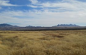
Prairie with the Santa Rita Mountains in the background.
|
|
| Geography | |
| Country | United States |
| State | Arizona |
| Communities | Vail and Sonoita |
| Borders on | |
| River | Cienega Creek |
Cienega Valley is a beautiful valley located in Arizona, a state in the United States. It's found southeast of a city called Tucson. This valley is special because it sits right where two big deserts meet: the Sonoran and Chihuahuan Deserts.
The valley is surrounded by several mountain ranges. To the north are the Rincon Mountains. To the east, you'll find the Whetstone Mountains. The Mustang Mountains are to the southeast, and the Canelo Hills are to the south. Finally, the Santa Rita-Empire Mountains complex is to the west.
Much of Cienega Valley is now part of the Las Cienegas National Conservation Area. This area helps protect many different kinds of plants and animals. Some of these species are even threatened, meaning they need special care to survive. The conservation area also protects the land along Cienega Creek.
Communities and History
Several towns and historic places are found in or near Cienega Valley.
Modern Towns
The town of Vail, Arizona, is located at the northwestern edge of the valley. It's right next to the Colossal Cave Mountain Park, a fun place to explore caves.
The small community of Sonoita is in the southwestern part of the valley. It's just a few miles south of the historic Empire Ranch.
Empire Ranch
The Empire Ranch is a very old and important place in the valley. Today, it serves as the main office for the Las Cienegas National Conservation Area. It's also a local history museum. You can visit and learn about what life was like long ago in this area.
Ghost Towns
Cienega Valley is also home to some interesting ghost towns. These are places where people used to live and work, but now they are mostly empty.
- Greaterville, Kentucky Camp, and Total Wreck are located on the western side of the valley. They are in the foothills of the Santa Rita and Empire mountains.
- The ghost town of Pantano is near the northern edge of the valley. It sits at the foot of the Rincon Mountains.
-
Cienega Valley, with the Whetstones and the Mustang Mountains in the background.
-
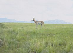
A pronghorn antelope in the Cienega Valley.
-
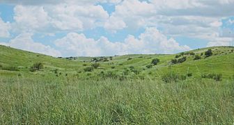
Prairie, green after the summer monsoon.
-
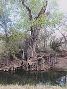
A cottonwood tree along Cienega Creek.


