Cinder Cone (British Columbia) facts for kids
Quick facts for kids Cinder Cone |
|
|---|---|
 |
|
| Highest point | |
| Elevation | 1,910 m (6,270 ft) |
| Prominence | 120 m (390 ft) |
| Geography | |
| Location | British Columbia, Canada |
| Parent range | Garibaldi Ranges |
| Topo map | NTS 92G/14 |
| Geology | |
| Age of rock | Holocene |
| Mountain type | Cinder cone |
| Volcanic arc/belt | Cascade Volcanic Arc Garibaldi Volcanic Belt |
| Last eruption | Holocene |
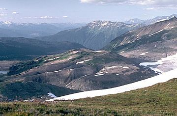
Cinder Cone is a special type of volcano called a cinder cone. It has a small crater (a bowl-shaped opening) on its west side. You can find Cinder Cone near the Helm Glacier in Garibaldi Provincial Park in British Columbia, Canada.
What is Cinder Cone?
Cinder Cone is surrounded by flat areas made of volcanic ash and small rocks. Its crater fills up with meltwater (water from melting snow and ice) during the summer months.
How Cinder Cone Changes
During the spring, when snow melts, the water easily washes away the loose volcanic ash and rocks from Cinder Cone. This material flows into an area known as the Valley of Desolation.
Cinder Cone's Ancient Lava Flow
Long, long ago, during a time called the early Holocene (which means it happened thousands of years ago), Cinder Cone produced a very long lava flow. This flow stretched for about 9 kilometers (that's about 5.6 miles)!
 | May Edward Chinn |
 | Rebecca Cole |
 | Alexa Canady |
 | Dorothy Lavinia Brown |

