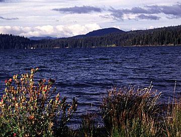
Cinnamon Butte facts for kids
Quick facts for kids Cinnamon Butte |
|
|---|---|
 |
|
| Highest point | |
| Elevation | 6,427 ft (1,959 m) NAVD 88 |
| Geography | |
| Location | Douglas County, Oregon, U.S. |
| Parent range | Cascades |
| Topo map | USGS Mount Thielsen |
| Geology | |
| Age of rock | Holocene? |
| Mountain type | Cinder cone |
| Volcanic arc | Cascade Volcanic Arc |
| Last eruption | More than 6845 years ago |
Cinnamon Butte is a group of old cinder cone volcanoes and lava domes. You can find them in the Cascade Range in Oregon. These volcanoes are very ancient. All of them are older than about 6,845 years. We know this because they are covered in ash. This ash came from a massive eruption of Mount Mazama a long, long time ago.
Cinnamon Butte: Oregon's Ancient Volcanoes
Cinnamon Butte is not just one single mountain. It's a collection of several smaller volcanoes. These types of volcanoes are called cinder cones. They are usually cone-shaped hills. They are built from volcanic ash and rock pieces that erupt from a single vent.
Some parts of Cinnamon Butte are also lava domes. A lava dome forms when thick, sticky lava slowly oozes out of a volcano. It piles up around the vent instead of flowing far away. This creates a dome-shaped mound.
The Age of Cinnamon Butte
Scientists believe that all the volcanoes at Cinnamon Butte are very old. They are older than 6,845 years. How do we know this? Because they are covered in a layer of ash. This ash came from a huge volcanic eruption.
That eruption happened at Mount Mazama. Mount Mazama is now where Crater Lake is located. When Mount Mazama erupted, it sent ash far and wide. Since the Cinnamon Butte volcanoes are covered by this ash, it means they were already there when Mount Mazama exploded.
Other Important Vents in the Area
Cinnamon Butte is the main peak in this area. But there are other interesting volcanic vents nearby. These are also part of the same ancient volcanic activity. Here are some of them:
| Name | Elevation | Coordinates |
| Cinnamon Butte | 6,427 ft (1,959 m) | 43°14′27″N 122°06′35″W / 43.24083°N 122.10972°W |
| Kelsay Point | 4,918 ft (1,499 m) | 43°18′01″N 122°06′27″W / 43.3004038°N 122.1075315°W |
| Mule Peak | 6,840 ft (2,080 m) | 43°17′37″N 122°00′33″W / 43.2937389°N 122.0091944°W |
| Red Cinder Butte | 6,545 ft (1,995 m) | 43°16′20″N 122°03′38″W / 43.2723494°N 122.0605848°W |
| Thirsty Point | 5,942 ft (1,811 m) | 43°16′28″N 122°05′35″W / 43.2745710°N 122.0930861°W |
| Tenas Peak | 6,532 ft (1,991 m) | 43°19′27″N 122°02′09″W / 43.3242935°N 122.0358624°W |

