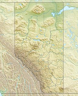
Coal Lake (Alberta) facts for kids
Quick facts for kids Coal Lake |
|
|---|---|
| Location | County of Wetaskiwin No. 10 / Leduc County, Alberta |
| Coordinates | 53°04′29″N 113°16′17″W / 53.07472°N 113.27139°W |
| Primary inflows | Pipestone Creek |
| Primary outflows | Pipestone Creek |
| Basin countries | Canada |
| Max. length | 11 km (6.8 mi) |
| Max. width | 0.66 km (0.41 mi) |
| Surface area | 10.9 km2 (4.2 sq mi) |
| Average depth | 3.5 m (11 ft) |
| Max. depth | 5.5 m (18 ft) |
| Surface elevation | 719 m (2,359 ft) |
| Settlements | Wetaskiwin |
Coal Lake is a long, winding lake in Alberta, Canada. It's located about 60 km (37 mi) southeast of Edmonton and just northeast of Wetaskiwin. This lake is part of an ancient river channel that formed after the last ice age.
Contents
How Coal Lake Was Formed
Coal Lake was created by powerful forces from the last ice age. About 10,000 years ago, a huge lake called Lake Edmonton covered a massive area. This lake was about 4,000 km2 (1,500 sq mi) in size.
Lake Edmonton existed for only about 100 years. It was held back by a giant ice dam. When this ice dam broke, the lake drained very quickly, in just a few weeks. This created huge channels in the land.
Coal Lake sits in one of these ancient meltwater channels. The North Saskatchewan River also follows another one of these channels.
Coal Lake's Journey and Location
The long meltwater channel that holds Coal Lake starts near Nisku, Alberta. It then winds its way southeast. Along this path, it connects several smaller lakes and depressions.
These include Saunders Lake, Ord Lake, and three other small unnamed lakes. Finally, the channel reaches Coal Lake and then continues to Driedmeat Lake.
Coal Lake itself begins east of Kavanagh, Alberta. It stretches for about 11 km (6.8 mi) before ending at a dam.
Controlling the Water: The Dam
A dam was built at the end of Coal Lake in 1972. This dam is located about 2 kilometres (1.2 mi) northwest of Gwynne, Alberta.
Since the dam was built, Pipestone Creek flows through the southern part of Coal Lake. This creek then drains the lake's water. The water from Coal Lake eventually flows into the Battle River. The Battle River is about 10 kilometres (6.2 mi) southeast of Coal Lake.
Why Is It Called Coal Lake?
Coal Lake got its name in 1892. A land surveyor named J.D.A. Fitzpatrick named it. He chose the name because there were many coal beds found along the northeast shore of the lake.
 | DeHart Hubbard |
 | Wilma Rudolph |
 | Jesse Owens |
 | Jackie Joyner-Kersee |
 | Major Taylor |


