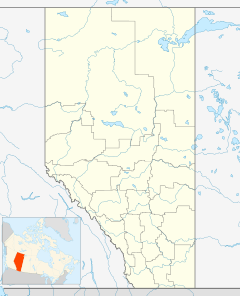
Gwynne, Alberta facts for kids
Quick facts for kids
Gwynne
|
|
|---|---|
|
Hamlet
|
|
| Country | Canada |
| Province | Alberta |
| Region | Central Alberta |
| Census division | No. 11 |
| Municipal district | County of Wetaskiwin No. 10 |
| Settled | 1902 |
| Named for | Julia Maude Schreiber (née Gwynne) |
| Area
(2021)
|
|
| • Land | 0.5 km2 (0.2 sq mi) |
| Population
(2021)
|
|
| • Total | 93 |
| • Density | 185.4/km2 (480/sq mi) |
| Time zone | UTC-7 (Mountain Time Zone) |
| • Summer (DST) | UTC-6 (Mountain Time Zone) |
| Postal code |
T0C 1L0
|
| Area codes | 780 |
| Highways | Highway 13 |
Gwynne is a small community called a hamlet in central Alberta, Canada. It's located on Highway 13, about 11 kilometers (7 miles) east of a town called Wetaskiwin.
History of Gwynne
In 1902, an early settler named Charles Rodberg opened a store and a post office. This area was first known as Rodberg's Crossing or Rodberg's Flat.
Later, the community was named Diana, after Charles Rodberg's oldest child. The post office was also called the Diana Post Office.
When the Canadian Pacific Railway (CPR) arrived in 1905, the community's name was changed again. It was renamed Gwynne to honor Julia Maude Schreiber, who was the wife of a railway official. Her husband, Sir Collingwood Schreiber, helped build railways and was a chief engineer for the CPR.
Gwynne's Climate
Gwynne has a "Humid Continental Climate," which scientists call "Dfb" in the Köppen Climate Classification system. This means it has warm summers and cold, snowy winters. The temperatures can change a lot between summer and winter.
| Climate data for Gwynne, Alberta | |||||||||||||
|---|---|---|---|---|---|---|---|---|---|---|---|---|---|
| Month | Jan | Feb | Mar | Apr | May | Jun | Jul | Aug | Sep | Oct | Nov | Dec | Year |
| Record high °C (°F) | 9.0 (48.2) |
14.0 (57.2) |
25.0 (77.0) |
28.5 (83.3) |
31.1 (88.0) |
33.0 (91.4) |
34.5 (94.1) |
35.0 (95.0) |
34.0 (93.2) |
29.5 (85.1) |
21.7 (71.1) |
18.0 (64.4) |
35.0 (95.0) |
| Mean daily maximum °C (°F) | −6.6 (20.1) |
−3.2 (26.2) |
1.9 (35.4) |
11.2 (52.2) |
17.5 (63.5) |
21.0 (69.8) |
23.2 (73.8) |
22.9 (73.2) |
17.6 (63.7) |
10.7 (51.3) |
0.2 (32.4) |
−4.8 (23.4) |
9.3 (48.7) |
| Daily mean °C (°F) | −12.4 (9.7) |
−9.5 (14.9) |
−4 (25) |
4.3 (39.7) |
10.3 (50.5) |
14.2 (57.6) |
16.3 (61.3) |
15.3 (59.5) |
10.3 (50.5) |
3.9 (39.0) |
−5.2 (22.6) |
−10.4 (13.3) |
2.4 (36.3) |
| Mean daily minimum °C (°F) | −18 (0) |
−15.8 (3.6) |
−9.9 (14.2) |
−2.6 (27.3) |
3.0 (37.4) |
7.4 (45.3) |
9.4 (48.9) |
8.2 (46.8) |
3.0 (37.4) |
−2.9 (26.8) |
−10.5 (13.1) |
−16 (3) |
−3.7 (25.3) |
| Record low °C (°F) | −46.0 (−50.8) |
−43.5 (−46.3) |
−39 (−38) |
−29.5 (−21.1) |
−8.0 (17.6) |
−2.5 (27.5) |
−0.6 (30.9) |
−3.0 (26.6) |
−9.5 (14.9) |
−26.0 (−14.8) |
−34.5 (−30.1) |
−46.1 (−51.0) |
−46.1 (−51.0) |
| Average precipitation mm (inches) | 22.5 (0.89) |
14.0 (0.55) |
21.6 (0.85) |
29.8 (1.17) |
52.9 (2.08) |
76.3 (3.00) |
101.9 (4.01) |
60.1 (2.37) |
44.2 (1.74) |
21.5 (0.85) |
17.1 (0.67) |
14.6 (0.57) |
476.6 (18.76) |
| Average rainfall mm (inches) | 1.5 (0.06) |
0.7 (0.03) |
1.7 (0.07) |
19.5 (0.77) |
49.0 (1.93) |
76.3 (3.00) |
101.9 (4.01) |
60.1 (2.37) |
43.2 (1.70) |
12.5 (0.49) |
2.4 (0.09) |
0.9 (0.04) |
369.8 (14.56) |
| Average snowfall cm (inches) | 21.0 (8.3) |
13.0 (5.1) |
20.0 (7.9) |
10.0 (3.9) |
4.0 (1.6) |
0.0 (0.0) |
0.0 (0.0) |
0.0 (0.0) |
1.0 (0.4) |
9.0 (3.5) |
15.0 (5.9) |
14.0 (5.5) |
107.0 (42.1) |
| Source: Environment Canada | |||||||||||||
Population of Gwynne
Every few years, Statistics Canada counts how many people live in different places. This is called a census.
In the 2021 Census, Gwynne had a population of 93 people. They lived in 41 homes. This was an increase from 73 people in 2016.
Gwynne covers a small area of about 0.5 square kilometers (0.19 square miles). In 2021, this meant there were about 185 people living in each square kilometer.
In the 2016 Census, Gwynne had 73 people living in 31 homes. This was a decrease from 88 people in 2011.
 | Jackie Robinson |
 | Jack Johnson |
 | Althea Gibson |
 | Arthur Ashe |
 | Muhammad Ali |


