Division No. 11, Alberta facts for kids
Quick facts for kids
Division No. 11
|
|
|---|---|
|
Census division in Alberta
|
|
| Country | Canada |
| Province | Alberta |
| Area | |
| • Total | 15,768 km2 (6,088 sq mi) |
| As of 2011 | |
| Population
(2021)
|
|
| • Total | 1,462,041 |
| • Density | 92.7220/km2 (240.149/sq mi) |
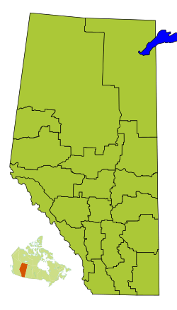
Division No. 11 is a special area in Alberta, Canada. It's called a census division because Statistics Canada uses it to count people. This division mostly surrounds the big city of Edmonton.
Most of Division No. 11 is part of Alberta's Capital Region. This is where the provincial government is located. The western and southern parts are in central Alberta. This area also forms the northern part of the busy Calgary–Edmonton Corridor, a major travel route.
Contents
What is Division No. 11?
Division No. 11 is a large area in Alberta. It's used for counting how many people live there. Think of it like a big neighbourhood or district. It helps the government understand where people live.
This division covers a huge space. It includes many different kinds of communities. From big cities to small villages, they are all part of Division No. 11.
Communities in Division No. 11
| Historical population | ||
|---|---|---|
| Year | Pop. | ±% |
| 1991 | 876,292 | — |
| 1996 | 898,888 | +2.6% |
| 2001 | 975,477 | +8.5% |
| 2006 | 1,076,103 | +10.3% |
| 2011 | 1,203,115 | +11.8% |
| 2016 | 1,366,050 | +13.5% |
| 2021 | 1,462,041 | +7.0% |
Division No. 11 is home to many different communities. These are called census subdivisions. They include cities, towns, and even smaller places.
Major Cities
The biggest cities in Division No. 11 are:
Towns and Villages
There are also many towns and villages. These are smaller than cities. Some examples include:
Other Communities
Division No. 11 also has other types of communities. These include:
- Summer villages: These are often places where people have cabins for holidays.
- Hamlets: These are very small communities without their own local government.
- Specialized municipalities: These are unique areas like Strathcona County.
- Municipal districts: These are large rural areas.
- Indian reserves: These are lands set aside for First Nations people.
How Many People Live Here?
We can find out how many people live in Division No. 11. This information comes from the 2021 Census of Population. It's like a big count of everyone in Canada.
In 2021, about 1,462,041 people lived in Division No. 11. This was a good increase from 2016. The area covers about 15,746 square kilometres. This means many people live in a fairly large space.
 | John T. Biggers |
 | Thomas Blackshear |
 | Mark Bradford |
 | Beverly Buchanan |


