Division No. 9, Alberta facts for kids
Quick facts for kids
Division No. 9
|
|
|---|---|
|
Census division in Alberta
|
|
| Country | Canada |
| Province | Alberta |
| Area | |
| • Total | 18,922 km2 (7,306 sq mi) |
| Population
(2021)
|
|
| • Total | 20,569 |
| • Density | 1.08704/km2 (2.81542/sq mi) |
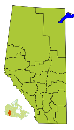
Division No. 9 is a special area in Alberta, Canada. Think of it like a big region used for counting people and organizing local areas. It's located in the southwest part of central Alberta. The biggest town here is Rocky Mountain House. The borders of Division No. 9 are the same as the borders of Clearwater County.
What is Division No. 9?
Division No. 9 is a "census division." This means it's an area that Statistics Canada uses to collect information about people. They count how many people live there and learn about their communities.
Towns and Villages in Division No. 9
This area includes several towns, villages, and other communities. These are called "census subdivisions." They are like smaller neighborhoods or cities within the larger Division No. 9.
- Towns
- Villages
- Hamlets
- Summer Villages
- Burnstick Lake
- Municipal Districts
- Indian Reserves
How Many People Live Here?
The number of people living in Division No. 9 changes over time. This is called the "population."
| Historical population | ||
|---|---|---|
| Year | Pop. | ±% |
| 1991 | 16,734 | — |
| 1996 | 18,196 | +8.7% |
| 2001 | 19,573 | +7.6% |
| 2006 | 20,351 | +4.0% |
| 2011 | 21,290 | +4.6% |
| 2016 | 20,869 | −2.0% |
| 2021 | 20,569 | −1.4% |
In 2021, Statistics Canada counted the population of Division No. 9. There were 20,569 people living there. They lived in 8,138 homes. This was a small change from 2016, when 20,869 people lived in the area.
The total land area of Division No. 9 is about 18,835 square kilometers. This means that in 2021, there were about 1.1 people living in each square kilometer. This is called "population density."
 | Charles R. Drew |
 | Benjamin Banneker |
 | Jane C. Wright |
 | Roger Arliner Young |


