
Strathcona County facts for kids
Quick facts for kids
Strathcona County
|
||
|---|---|---|
|
Specialized municipality
|
||
|
||

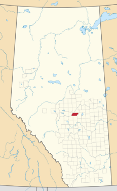
Location within Alberta
|
||
| Country | Canada | |
| Province | Alberta | |
| Region | Edmonton Metropolitan Region | |
| Census division | No. 11 | |
| - Municipal district | 1943 | |
| - Specialized municipality | January 1, 1996 | |
| Named for | Donald Smith, 1st Baron Strathcona and Mount Royal | |
| Area
(2021)
|
||
| • Land | 1,170.65 km2 (451.99 sq mi) | |
| Population
(2021)
|
||
| • Total | 99,225 | |
| • Density | 84.8/km2 (220/sq mi) | |
| • Municipal census (2022) | 100,362 | |
| Time zone | UTC-7 (MST) | |
| • Summer (DST) | UTC-6 (MDT) | |
Strathcona County is a special type of community in Alberta, Canada. It's located near the big city of Edmonton and close to Elk Island National Park. It's part of a larger area known as the Edmonton Metropolitan Region.
Strathcona County is a mix of city life and country living. Most people (about 71%) live in a busy area called Sherwood Park. Sherwood Park is like a city, but it's still part of the county. The rest of the people live in the beautiful rural areas around it.
Contents
History of Strathcona County
The land that is now Strathcona County was originally home to First Nations people. They signed Treaty 6, which allowed for settlement in the area.
Local government started here in 1893. It was first called Statute Labour District No. 2. Over time, the area grew and its name changed several times. In 1913, it became Local Improvement District (LID) No. 517.
In 1918, LID No. 517 became a municipal district called the Municipal District (MD) of Clover Bar No. 517. At the same time, a nearby area to the south became the MD of Strathcona No. 518.
- Predecessor municipalities (1918-1943)
-

Boundaries of the M.D. of Clover Bar No. 517
-
Boundaries of the M.D. of Strathcona No. 518


On March 1, 1943, these two municipal districts, Clover Bar No. 517 and Strathcona No. 518, joined together. The new, larger district was named the MD of Strathcona No. 517. Later, in 1945, it was renumbered to MD of Strathcona No. 83.
On January 1, 1962, the MD of Strathcona No. 83 joined with the Clover Bar School Division No. 13. This made it a county called the County of Strathcona No. 20.
In 1995, the county status changed back to a municipal district, but it kept the name County of Strathcona No. 20. Then, on April 26, 1995, its name officially became Strathcona County.
Finally, on January 1, 1996, Strathcona County became a specialized municipality. This special status was created to help manage a community that has both a large urban area (like Sherwood Park) and a big rural area with many people. Sherwood Park is treated like a city, while the rural parts are like a municipal district.
Geography and Nature
Strathcona County is in the middle of Alberta. It's the eastern part of the Edmonton Metropolitan Region. It shares borders with other counties like Lamont County and Beaver County. The North Saskatchewan River forms part of its northern border.
The county is also home to several lakes, including Cooking Lake, Half Moon Lake, and Hastings Lake. These lakes are great places for outdoor activities.
Communities in Strathcona County
Strathcona County has different types of communities within its borders.
- Cities:
- Fort Saskatchewan (This city is surrounded by Strathcona County but is its own separate municipality.)
- Hamlets: These are smaller communities within Strathcona County.
- Antler Lake
- Ardrossan
- Collingwood Cove
- Half Moon Lake
- Hastings Lake
- Josephburg
- North Cooking Lake
- Sherwood Park (This is the main urban area of the county.)
- South Cooking Lake
There are also many smaller areas called "localities" throughout the county.
Population and People
Strathcona County has been growing steadily. In 2021, the population was 99,225 people. This means it's a busy and active place to live.
Most of the county's population lives in the urban area of Sherwood Park. The rest live in the beautiful rural areas.
Diverse Backgrounds
People from many different backgrounds live in Strathcona County. The largest group is of European descent. There are also many Indigenous residents, as well as people from Southeast Asia, South Asia, East Asia, Africa, Latin America, and the Middle East. This mix of cultures makes Strathcona County a vibrant place.
Economy and Jobs
Strathcona County has a strong economy, especially in industry.
Industrial Growth
The county is known for its large industrial area called Refinery Row, located on the west side of Sherwood Park. This area has some of the biggest oil refineries in Western Canada. For example, Imperial Oil and Suncor Energy have large refineries here that produce gasoline, diesel, and jet fuel.
Strathcona County is a key part of Alberta's Industrial Heartland, which is Canada's largest area for refining oil and gas. Many companies here work with energy, manufacturing, and engineering. Some companies even make robots that check pipelines!
Local Businesses
The county is also home to more than 11,000 businesses. Many people in Strathcona County are highly skilled, with lots of diplomas and degrees. This helps local businesses grow.
The county offers support for new businesses and entrepreneurs. They have events like Small Business Week and provide resources for planning and starting a business.
Arts and Culture
The Strathcona County Library is a public library with its main branch in Sherwood Park. It also has a special bookmobile that travels to rural areas, making sure everyone can borrow books and use library services.
Fun Places to Visit
Elk Island National Park is right next to Strathcona County. It's a fantastic place to see wildlife like bison and elk, go hiking, or enjoy nature.
Transportation and Roads
Strathcona County has good transportation links, including airports and a network of highways.
Airports
The county has two public airports:
- Cooking Lake Airport: This is the main airport for the county's public air travel. It's also the oldest operating public airport in Canada!
- Warren Thomas Aerodrome (Josephburg Airport): This airport serves the remaining air travel needs for the county.
Roads and Highways
Many important provincial highways run through Strathcona County, making it easy to travel around. These include:
- Highway 14 (Poundmaker Highway)
- Highway 15
- Highway 16 (Yellowhead Highway, part of the Trans-Canada Highway)
- Highway 21
- Highway 100 (Sherwood Park Freeway)
- Highway 216 (Anthony Henday Drive)
- Wye Road (Highway 630)
Public Transit
Strathcona County Transit provides bus services for residents, helping people get around the county and to nearby Edmonton.
Sports
Strathcona County is home to the Strathcona Druids RFC, a local rugby football club.
