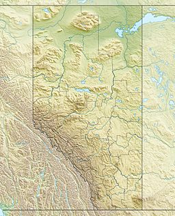
Driedmeat Lake (Alberta) facts for kids
Quick facts for kids Driedmeat Lake |
|
|---|---|
| Location | Camrose County, Alberta |
| Coordinates | 52°51′53″N 112°44′59″W / 52.86472°N 112.74972°W |
| Type | Lake |
| Primary inflows | Battle River |
| Primary outflows | Battle River |
| Basin countries | Canada |
| Max. length | 15.6 km (9.7 mi) |
| Max. width | 0.9 km (0.56 mi) |
| Surface area | 16.5 km2 (6.4 sq mi) |
| Average depth | 2.2 m (7 ft 3 in) |
| Max. depth | 3.7 m (12 ft) |
| Water volume | 41,900,000 m3 (1.48×10⁹ cu ft) |
| Residence time | 0.25 years |
| Shore length1 | 41.2 km (25.6 mi) |
| Surface elevation | 684.44 m (2,245.5 ft) |
| Settlements | Tillicum Beach |
| 1 Shore length is not a well-defined measure. | |
Driedmeat Lake is a long, narrow lake in Alberta, Canada. It is part of the Battle River system. The lake's northern end is about 10 km (6.2 mi) south of Camrose. The city of Camrose gets its drinking water from Driedmeat Lake.
This lake was formed by a channel of water from melting glaciers. Around the lake, you can find Saskatoon berries. These berries were an important ingredient in pemmican, a traditional food.
Contents
How Driedmeat Lake Was Formed
Driedmeat Lake sits in a channel carved by melting ice. This happened at the end of the last ice age. A huge lake called Lake Edmonton once covered 4,000 km2 (1,500 sq mi). It existed for about 100 years. When its ice dam broke, the lake drained very quickly. This created the channels we see today.
The meltwater channel starts near Nisku. It winds southeast through several smaller lakes. These include Saunders Lake, Ord Lake, and Coal Lake. The Battle River flows into the northern part of Driedmeat Lake. Then, it flows out from the southern end.
History of the Lake Area
Long ago, before Europeans arrived, the Blackfoot and Cree peoples used the land around Driedmeat Lake. They would set up camps and hunt here. The name "Driedmeat" comes from a Cree word. It describes the process of drying Bison meat to make pemmican. There is also a nearby hill called Driedmeat, which gave the lake its name.
In 1885, a man named Joseph Tyrrell visited the area. He described a settlement of about forty Metis families. They lived in strong log houses near the Battle River. They grew their own food like wheat, barley, and potatoes. They also raised healthy animals such as horses, cattle, and sheep.
Nature Around Driedmeat Lake
Driedmeat Lake has many nutrients in its water. This means it can sometimes have a lot of plant growth.
Plants in the Lake
The most common plant in Driedmeat Lake is a type of blue-green algae. You can also see many larger water plants, especially at the north and south ends. These plants can form thick mats on the surface. This sometimes makes it hard for boats to travel.
In 1984, scientists found fourteen types of water plants in the lake. The most common ones were pondweeds and coontail.
Animals and Birds
Driedmeat Lake is a very important place for birds. Many waterfowl, like ducks and geese, build their nests here. It is also a key resting spot for swans and Canada geese in the fall. Large groups of White Pelicans also feed on the lake.
In 1939, people asked the government to make the lake a bird sanctuary. Today, the area is a Restricted Wildlife Area. This means hunting waterfowl and other game birds is not allowed close to the lake for most of the year. Hunting is allowed later in the year to encourage birds to keep migrating south.
A man named Frank Farley owned a farm by Driedmeat Lake. In 1932, he wrote a book called Birds of the Battle River Region. He shared his own observations of birds on his land.
Fish in the Lake
Driedmeat Lake is a popular spot for fishing. People enjoy catching northern pike in the summer. They also go ice-fishing in the winter. Other fish found here include longnose dace, lake chub, and white sucker. Officials estimate there are many pike in the lake.
How People Use Driedmeat Lake
Driedmeat Lake provides water for the city of Camrose. On a typical day, the people of Camrose use millions of litres of water from the lake.
In 2010, the lake's water level was raised. A new structure called a weir was built. This project cost over a million dollars. It also included changes to the fishway and a new public access road.
 | Tommie Smith |
 | Simone Manuel |
 | Shani Davis |
 | Simone Biles |
 | Alice Coachman |


