Coatzacoalcos River facts for kids
Quick facts for kids Coatzacoalcos |
|
|---|---|

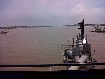
Approaching the mouth of the river from the Gulf of Mexico. The city of Coatzacoalcos is to starboard, and Allende to port. (2011)
|
|
 |
|
|
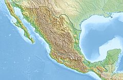
Location of mouth
|
|
| Country | Mexico |
| State | Oaxaca, Veracruz |
| Region | Isthmus of Tehuantepec |
| Cities | Matías Romero, Minatitlán, Nanchital, Coatzacoalcos |
| Physical characteristics | |
| Main source | 16°56′44″N 94°37′1″W / 16.94556°N 94.61694°W |
| River mouth | 0 m (0 ft) 18°9′56″N 94°24′50″W / 18.16556°N 94.41389°W |
| Length | 325 km (202 mi) |
| Basin features | |
| Basin size | 17,563 km2 (6,781 sq mi) |
| Tributaries |
|
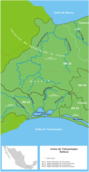
The Coatzacoalcos River is a very important river in Mexico. It flows mainly through the southern part of the state of Veracruz. This river starts in the Sierra de Niltepec mountains. It then crosses the state of Oaxaca in a region called the Isthmus of Tehuantepec.
The Coatzacoalcos River flows for about 325 kilometers (202 miles). It eventually empties into the Gulf of Mexico. Many smaller rivers, called tributaries, flow into it. These include the El Corte, Sarabia, Jaltepec, Chalchijalpa, El Chiquito, Uxpanapa, and Calzadas rivers. When all these rivers join, they create one of the strongest river flows in the whole area. About two-thirds of the river is deep enough for boats to travel on.
European explorers first found the river in 1518. This was during an expedition led by Juan de Grijalva. Later, Hernán Cortés sent Diego de Ordaz to explore the river. They wanted to see if it could be used as a good port for ships.
River's History
The Coatzacoalcos River has a long and interesting history. It is one of Mexico's most important rivers. The oldest known map of this river was drawn in 1580 by Francisco Gali. This map looked very much like European maps of the time. It was similar to a nautical chart, which sailors use.
Experts believe the map was drawn quickly. There are mistakes in the distances shown and many corrections. This suggests it was made in a hurry. Francisco Gali was an explorer and sailor. He was very interested in connecting the Atlantic Ocean ("North Sea") and the Pacific Ocean ("South Sea"). He thought the Strait of Tehuantepec could be a good passage. The map of Coatzacoalcos was likely drawn to show that the river could be part of this important route.
The Serpent Legend
The name Coatzacoalcos comes from an old legend. It is a story from the Mesoamerican people. According to this legend, the god Quetzalcoatl traveled on a raft. This raft was said to be made of a serpent's skin. He sailed away until he disappeared over the horizon.
Because of this story, the river became known as Coatzacoalcos. In the Nahuatl language, this name means "the place where the serpent hides." It's a very cool name for a river!
Important Port
The city of Coatzacoalcos is located right where the river meets the sea. This city has one of Mexico's busiest and most industrial ports. It is considered the third most important port in the entire Gulf of Mexico.
The port is a key way to transport goods for international trade. It helps local businesses that deal with farming, forestry, and general commerce. This makes the port very important for the whole Isthmus of Tehuantepec region.
Environmental Concerns
Unfortunately, the Coatzacoalcos River faces environmental challenges. It is known to have some pollution. This is partly because there haven't been enough rules to protect the water.
One of the main sources of pollution comes from the petrochemical industry. This industry processes oil and gas. Organizations like the Mexican Center of Environmental Law (CEMDA) are working to address these issues. They want to make sure the river's water becomes cleaner and healthier for everyone.
See also
 In Spanish: Río Coatzacoalcos para niños
- CG Railway
- List of longest rivers of Mexico
- Selva Zoque
 | John T. Biggers |
 | Thomas Blackshear |
 | Mark Bradford |
 | Beverly Buchanan |


