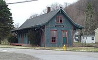
Cohocton, New York facts for kids
Quick facts for kids
Cohocton
|
|
|---|---|
| Country | United States |
| State | New York |
| County | Steuben |
| Established | 1812 |
| Area | |
| • Total | 56.09 sq mi (145.27 km2) |
| • Land | 56.08 sq mi (145.25 km2) |
| • Water | 0.01 sq mi (0.02 km2) |
| Population
(2020)
|
|
| • Total | 2,268 |
| • Estimate
(2021)
|
2,239 |
| • Density | 44.49/sq mi (17.18/km2) |
| Time zone | UTC-5 (Eastern (EST)) |
| • Summer (DST) | UTC-4 (EDT) |
| FIPS code | 36-101-16738 |
Cohocton is a town located in Steuben County, New York, United States. In 2020, about 2,268 people lived here. The town also contains a village that shares the same name, Cohocton. It's found in the northwestern part of Steuben County.
Contents
History of Cohocton
The area that is now Cohocton was first settled around 1794. The town itself was officially formed in 1812. It was created from parts of two other towns, Bath and Dansville.
How Cohocton Got Its Name
When it was first formed, Cohocton was called the town of Liberty. Over time, parts of the town were used to create new towns. These included Avoca in 1843 and Wayland in 1848. In 1874, the town grew bigger when a piece of Prattsburgh was added.
Interestingly, in the early 1800s, people sometimes spelled the name "Cohocton" and "Conhocton." But by 1860, the shorter spelling became the official one.
Historic Buildings in Cohocton
The Larrowe House is a special building in the village of Cohocton. It's also known as the Cohocton Town and Village Hall. This building was added to the National Register of Historic Places in 1989. This means it's an important historical site that should be protected.
Geography of Cohocton
The town of Cohocton covers about 56.1 square miles (145.2 square kilometers) of land. There is almost no water area within the town's borders.
Location and Borders
The northern edge of Cohocton borders two other counties: Livingston County and Ontario County.
Roads and Rivers
Several important roads pass through Cohocton. These include Interstate 390, New York State Route 21, New York State Route 371, and New York State Route 415. Interstate 390 and NY-415 partly follow the path of the Cohocton River.
People of Cohocton
| Historical population | |||
|---|---|---|---|
| Census | Pop. | %± | |
| 1820 | 1,560 | — | |
| 1830 | 2,711 | 73.8% | |
| 1840 | 2,965 | 9.4% | |
| 1850 | 1,993 | −32.8% | |
| 1860 | 2,535 | 27.2% | |
| 1870 | 2,710 | 6.9% | |
| 1880 | 3,346 | 23.5% | |
| 1890 | 3,444 | 2.9% | |
| 1900 | 3,197 | −7.2% | |
| 1910 | 2,926 | −8.5% | |
| 1920 | 2,585 | −11.7% | |
| 1930 | 2,516 | −2.7% | |
| 1940 | 2,474 | −1.7% | |
| 1950 | 2,418 | −2.3% | |
| 1960 | 2,451 | 1.4% | |
| 1970 | 2,379 | −2.9% | |
| 1980 | 2,466 | 3.7% | |
| 1990 | 2,520 | 2.2% | |
| 2000 | 2,626 | 4.2% | |
| 2010 | 2,561 | −2.5% | |
| 2020 | 2,268 | −11.4% | |
| 2021 (est.) | 2,239 | −12.6% | |
| U.S. Decennial Census | |||
In 2000, there were 2,626 people living in Cohocton. These people lived in 972 households, and 704 of these were families. The population density was about 46.8 people per square mile.
Who Lives in Cohocton?
- About 38.7% of households had children under 18 living with them.
- Most households (57.5%) were married couples living together.
- About 28.8% of the population was under 18 years old.
- About 12.4% of the population was 65 years or older.
- The average age of people in Cohocton was 36 years old.
Communities and Locations in the Town of Cohocton
- Atlanta – This is a small community, or hamlet, in the northeast part of the town. It was started around 1840 and used to be called "Bloods." The Cohocton River changes direction here. The Presbyterian Church of Atlanta is a historic building listed on the National Register of Historic Places. Atlanta was an important shipping point for grapes grown nearby.
- Bowles Corners – You can find this spot in the northwest corner of the town. It's located where NY-21 and County Road 37 meet.
- Cohocton – This is the main village in the town, located in the southern part. It's right next to Interstate 390. For a while in the 1800s, this village was also called "Liberty."
- Kirkwood – Another hamlet located northeast of the Cohocton village, along NY-371.
- North Cohocton – This hamlet is in the northeast part of the town. It's at the meeting point of NY-21 and NY-371. This community has been around since before 1850.
Notable Person
- Charlotte Fowler Wells – She was a phrenologist (someone who studied personality based on skull shape) and a publisher.
See also
 In Spanish: Cohocton (Nueva York) para niños
 | Jewel Prestage |
 | Ella Baker |
 | Fannie Lou Hamer |


