
Coleville, California facts for kids
Quick facts for kids
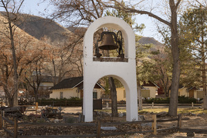
Coleville, California
|
|
|---|---|
Coleville
|
|

Coleville, California
Location in California

Coleville, California
Location in the United States
|
|
| Country | United States |
| State | California |
| County | Mono |
| Area | |
| • Total | 19.27 sq mi (49.90 km2) |
| • Land | 19.27 sq mi (49.90 km2) |
| • Water | 0.00 sq mi (0.00 km2) 0% |
| Elevation | 5,141 ft (1,567 m) |
| Population
(2020)
|
|
| • Total | 419 |
| • Density | 21.75/sq mi (8.40/km2) |
| Time zone | UTC-8 (Pacific) |
| • Summer (DST) | UTC-7 (PDT) |
| ZIP code |
96107
|
| Area codes | 442/760 (de jure); 530 (de facto) |
| FIPS code | 06-14484 |
| GNIS feature IDs | 1655911, 2582978 |
Coleville is a small community in Mono County, California. It's called a "census-designated place" (CDP) because the government tracks its population. Coleville is located in the Antelope Valley near the West Walker River. It sits at an elevation of about 5,141 feet (1,567 meters) above sea level.
In 2020, the population of Coleville was 419 people. This was a slight decrease from 495 people in 2010. The local ZIP Code is 96107.
Contents
History of Coleville
The first post office in Coleville opened in 1868. The community was named after Cornelius Cole, who was a United States senator.
In 2007, a large wildfire called the Larson fire threatened Coleville. It burned over 1,100 acres (445 hectares) of land.
Coleville is also known as the hometown of General John Abizaid. It is also the birthplace of Lillian Smith, a famous trick shooter.
Geography and Location
Coleville is one of the northernmost communities in Mono County. To its north is the community of Topaz. To the south, you'll find Walker.
U.S. Route 395 is a major highway that runs through Coleville. This road leads north to Carson City, Nevada, which is about 46 miles away. If you head southeast on the highway, you'll reach Bridgeport, the main town of Mono County, about 26 miles away.
Coleville's Climate
Coleville has a climate with warm, dry summers. The average monthly temperatures do not go above 71.6°F (22°C). This type of weather is known as a "warm-summer Mediterranean climate."
Community Services
Coleville has several important services that help the community.
Fire Protection
The Antelope Valley Fire Protection District protects Coleville from fires. This district was started in 1947. It covers about 33 square miles (85 square kilometers) of the Antelope Valley. The district also has a 12-acre (4.9-hectare) training center in Coleville.
Water Supply
The Antelope Valley Water District provides water to Coleville. This district was formed in 1961 to manage the water supply for the area.
Education in Coleville
Coleville is part of the Eastern Sierra Unified School District. There is an elementary school and Coleville High School located right in Coleville.
Because Coleville is far from other schools in California, Coleville High School competes in sports with schools in Nevada. This is done through the Nevada Interscholastic Activities Association. Coleville also has a public library for everyone to use.
Population Information
| Historical population | |||
|---|---|---|---|
| Census | Pop. | %± | |
| 2010 | 495 | — | |
| 2020 | 419 | −15.4% | |
| U.S. Decennial Census | |||
The 2010 United States Census counted 495 people living in Coleville. All of these people lived in homes, not in group living situations.
There were 171 households in Coleville. Many of these households (52.6%) had children under 18 living in them. The average household had about 2.89 people.
The population included people of different ages. About 33.7% of the population was under 18 years old. About 6.5% of the population was 65 years or older. The average age in Coleville was 25.7 years.
See also
 In Spanish: Coleville para niños
