Coliseum Mountain facts for kids
Quick facts for kids Coliseum Mountain |
|
|---|---|
| Highest point | |
| Elevation | 2,035 m (6,677 ft) |
| Prominence | 635 m (2,083 ft) |
| Naming | |
| Native name | [Yahareskin] Error: {{native name}}: unrecognized language tag: Mountain with a cap (help) (language?) |
| Geography | |
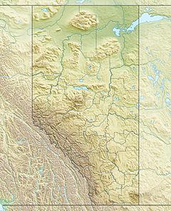
| Location | Nordegg, Alberta, Canada |
| Topo map | NTS 83 C/08 |
| Climbing | |
| Easiest route | Coliseum Trail |
Coliseum Mountain is a cool peak located north of Nordegg, a town in Alberta, Canada. It's part of the Canadian Rockies, a huge mountain range. This mountain stands tall at 2,035 meters (about 6,677 feet) high!
It got its name because its shape looks a bit like the famous Colosseum in ancient Rome. The Stoney First Nations people had their own name for it: Yahareskin. This means "mountain with a cap" because its top is bare.
Mountain History
Coliseum Mountain was first mapped in 1858. This was done by Sir James Hector during the Palliser Expedition. Later, in 1913, Martin Nordegg climbed the mountain. He was the person who started the coal mining town of Nordegg.
Fire Lookout Tower
Forestry Rangers started going to the top of Coliseum Mountain very early. As far back as 1914, they used the peak to look for forest fires. A special building called a mountain fire lookout was built there in 1927. This was when Nordegg was a busy coal mining town.
Building the lookout tower was a big job. It was the first fire lookout in Alberta. Lumber was carried up the mountain by packhorses. District Forest Ranger Bill Shankland was in charge of the construction.
Some people who lived in Nordegg remember climbing the mountain. They would deliver mail to the ranger who worked in the lookout. One ranger in the 1950s was named Leo Letourneau. Kids in town called him "Old Leo." They said he would use his telescope to watch what was happening in town. This lookout tower was later moved in 1955. It went to the top of Baldy Mountain, which is a neighboring peak.
Hiking Coliseum Mountain
Coliseum Mountain is a very popular spot for hiking. Many people visit it when they travel to Nordegg and along the David Thompson Highway.
Coliseum Trail
The most common way to reach the top is by hiking the Coliseum Trail. This trail is about 6.5 kilometers (4 miles) one way. So, a round trip is about 13 kilometers (8 miles). It's a non-motorized trail with switchbacks, which are zig-zag paths. Hikers gain about 635 meters (2,083 feet) in height.
To find the start of the Coliseum Trail, you need to go through the Nordegg North Subdivision. Follow the signs along Shunda Creek Road. Then, turn onto Baldy Mountain Road and go up to Eagle Drive.
Other Trails
There is also the Ridgeline Trail. This trail is longer and more challenging. It's about 7.2 kilometers (4.5 miles) to the peak. A round trip is 14.4 kilometers (9 miles). This trail starts at the Ranger Station, which is east of Nordegg. It climbs a ridge across from the Beaverdam Provincial Recreation Area.
Another option is the Ranger Station Trail. It also starts at the Ranger Station. This trail follows the base of the mountain. It eventually connects with either the Coliseum Trail or the Ridgeline Trail.
Some people try to climb the front face of the mountain. This starts from the Coliseum Staging Area. However, this path is very difficult and not clearly marked. It has tricky loose rock sections and steep climbs. It is not recommended for most hikers.
 | Tommie Smith |
 | Simone Manuel |
 | Shani Davis |
 | Simone Biles |
 | Alice Coachman |


