Colorado City, Colorado facts for kids
Quick facts for kids
Colorado City, Colorado
|
|
|---|---|

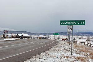
Entering Colorado City along State Highway 165, December 2014
|
|

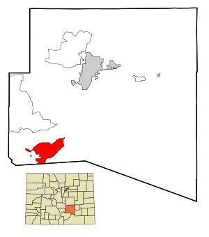
Location of the Colorado City CDP in Pueblo County, Colorado.
|
|
| Country | |
| State | |
| County | Pueblo County |
| Government | |
| • Type | metropolitan district |
| Area | |
| • Total | 15.070 sq mi (39.030 km2) |
| • Land | 14.956 sq mi (38.735 km2) |
| • Water | 0.114 sq mi (0.295 km2) |
| Elevation | 5,919 ft (1,804 m) |
| Population
(2020)
|
|
| • Total | 2,237 |
| • Density | 148.44/sq mi (57.315/km2) |
| Time zone | UTC-7 (MST) |
| • Summer (DST) | UTC-6 (MDT) |
| ZIP Code |
81019
|
| Area code(s) | 719 |
| GNIS feature ID | 2407647 |
| FIPS code | 08-15935 |
Colorado City is a special kind of community in Pueblo County, Colorado, United States. It's called a census-designated place (CDP). This means it's an area that the government counts for population, but it's not officially a city or town with its own local government. Instead, it's managed by Pueblo County.
Colorado City is part of the larger Pueblo, CO Metropolitan Statistical Area. This area includes Pueblo and nearby communities. The community also has its own post office with the ZIP Code 81019. In 2020, about 2,237 people lived in Colorado City. A group called the Colorado City Metropolitan District helps provide services to the area.
Geography
Colorado City is located in a beautiful area known as the Greenhorn Valley. This valley is surrounded by nature and offers a scenic environment.
The entire area of Colorado City covers about 39 square kilometers (or about 9,640 acres). A small part of this area, about 0.295 square kilometers (or 73 acres), is covered by water.
History
The very first settlement in the area where Colorado City now stands was called Greenhorn. It was named after an important Comanche chief from the 1700s, whose name was Cuerno Verde in Spanish.
In 1845, a mountain man named John Brown and his family started a trading post here. A trading post was a place where people could trade goods, like furs or supplies. Their post was located where the Trapper's Trail, a route to Taos, New Mexico, crossed Greenhorn Creek.
John Brown and his family moved to California in 1849. A few years later, in 1853, an army officer named Lt. Edward Griffin Beckwith visited Greenhorn. He noted that six families from New Mexico had built an irrigation system. This system helped them use water from Greenhorn Creek to grow crops like corn, wheat, beans, and watermelon. Their homes were made of adobe (a type of sun-dried brick) and were built close together. They also had corrals to keep their animals safe.
Population Information
| Colorado City CDP, Colorado | ||
|---|---|---|
| Year | Pop. | ±% |
| 1990 | 1,149 | — |
| 2000 | 2,018 | +75.6% |
| 2010 | 2,193 | +8.7% |
| 2020 | 2,237 | +2.0% |
| Source: United States Census Bureau | ||
The United States Census Bureau first officially recognized Colorado City as a CDP for the 1990 United States Census. Since then, the population has grown steadily. In 1990, there were 1,149 people, and by 2020, the population had nearly doubled to 2,237 residents.
Getting Around
Colorado City is connected to the state's transportation system through Bustang. This is a public bus service that helps people travel between different towns and cities in Colorado. Colorado City is a stop on the Trinidad-Pueblo Outrider line, making it easier for residents to get to larger cities like Pueblo.
See also
 In Spanish: Colorado City (Colorado) para niños
 | George Robert Carruthers |
 | Patricia Bath |
 | Jan Ernst Matzeliger |
 | Alexander Miles |


